

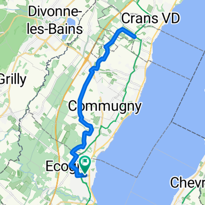
Route de Sauverny 120, Versoix à Chemin de Braille, Versoix
A cycling route starting in Versoix, Canton of Geneva, Switzerland.
Overview
About this route
- 1 h 25 min
- Duration
- 33.5 km
- Distance
- 204 m
- Ascent
- 220 m
- Descent
- 23.5 km/h
- Avg. speed
- 535 m
- Avg. speed

Route quality
Waytypes & surfaces along the route
Waytypes
Road
12.4 km
(37 %)
Busy road
11.7 km
(35 %)
Surfaces
Paved
16.5 km
(49 %)
Asphalt
16.4 km
(49 %)
Paved (undefined)
0 km
(<1 %)
Undefined
17 km
(51 %)
Continue with Bikemap
Use, edit, or download this cycling route
You would like to ride Route de Sauverny 120, Versoix à Chemin de Braille, Versoix or customize it for your own trip? Here is what you can do with this Bikemap route:
Free features
- Save this route as favorite or in collections
- Copy & plan your own version of this route
- Sync your route with Garmin or Wahoo
Premium features
Free trial for 3 days, or one-time payment. More about Bikemap Premium.
- Navigate this route on iOS & Android
- Export a GPX / KML file of this route
- Create your custom printout (try it for free)
- Download this route for offline navigation
Discover more Premium features.
Get Bikemap PremiumFrom our community
Other popular routes starting in Versoix
 Versoix - Vesancy - Foret du Turet
- Distance
- 38.3 km
- Ascent
- 1,023 m
- Descent
- 1,023 m
- Location
- Versoix, Canton of Geneva, Switzerland
 Route Suisse 16, Mies to Rue de l'Aubépine 9–11, Geneva
- Distance
- 50.7 km
- Ascent
- 342 m
- Descent
- 347 m
- Location
- Versoix, Canton of Geneva, Switzerland
 Sunday Afternoon with M....
- Distance
- 29.5 km
- Ascent
- 153 m
- Descent
- 154 m
- Location
- Versoix, Canton of Geneva, Switzerland
 Versoix - Aubonne - Versoix
- Distance
- 80.1 km
- Ascent
- 401 m
- Descent
- 398 m
- Location
- Versoix, Canton of Geneva, Switzerland
 Céligny
- Distance
- 22.6 km
- Ascent
- 158 m
- Descent
- 157 m
- Location
- Versoix, Canton of Geneva, Switzerland
 Versoix rive gauche/Mont mourex/bois de versoix
- Distance
- 30.9 km
- Ascent
- 379 m
- Descent
- 378 m
- Location
- Versoix, Canton of Geneva, Switzerland
 b9 Col de la Faucille
- Distance
- 72.8 km
- Ascent
- 1,153 m
- Descent
- 1,150 m
- Location
- Versoix, Canton of Geneva, Switzerland
 Chemin de Villars 26, Versoix à Avenue de Choiseul 8, Versoix
- Distance
- 27.4 km
- Ascent
- 223 m
- Descent
- 225 m
- Location
- Versoix, Canton of Geneva, Switzerland
Open it in the app