
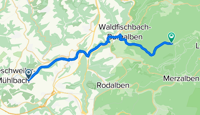
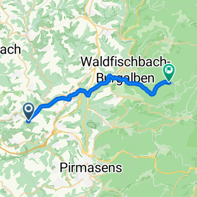
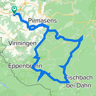
Flurstraße 2, Rieschweiler-Mühlbach nach K32, Heltersberg
A cycling route starting in Höheischweiler, Rhineland-Palatinate, Germany.
Overview
About this route
- 1 h 19 min
- Duration
- 18.6 km
- Distance
- 404 m
- Ascent
- 375 m
- Descent
- 14.1 km/h
- Avg. speed
- 296 m
- Avg. speed

Route quality
Waytypes & surfaces along the route
Waytypes
Road
7.4 km
(40 %)
Path
4.2 km
(23 %)
Surfaces
Paved
16.8 km
(90 %)
Unpaved
0.1 km
(<1 %)
Asphalt
13.2 km
(71 %)
Paved (undefined)
3.6 km
(20 %)
Continue with Bikemap
Use, edit, or download this cycling route
You would like to ride Flurstraße 2, Rieschweiler-Mühlbach nach K32, Heltersberg or customize it for your own trip? Here is what you can do with this Bikemap route:
Free features
- Save this route as favorite or in collections
- Copy & plan your own version of this route
- Sync your route with Garmin or Wahoo
Premium features
Free trial for 3 days, or one-time payment. More about Bikemap Premium.
- Navigate this route on iOS & Android
- Export a GPX / KML file of this route
- Create your custom printout (try it for free)
- Download this route for offline navigation
Discover more Premium features.
Get Bikemap PremiumFrom our community
Other popular routes starting in Höheischweiler
 Ostring 2, Rieschweiler-Mühlbach nach Birkweiler
- Distance
- 53.7 km
- Ascent
- 1,102 m
- Descent
- 1,214 m
- Location
- Höheischweiler, Rhineland-Palatinate, Germany
 Rund um Windsberg
- Distance
- 24.2 km
- Ascent
- 323 m
- Descent
- 323 m
- Location
- Höheischweiler, Rhineland-Palatinate, Germany
 Flurstraße 2, Rieschweiler-Mühlbach nach K32, Heltersberg
- Distance
- 18.6 km
- Ascent
- 404 m
- Descent
- 375 m
- Location
- Höheischweiler, Rhineland-Palatinate, Germany
 zuim Clausensee
- Distance
- 18.5 km
- Ascent
- 283 m
- Descent
- 270 m
- Location
- Höheischweiler, Rhineland-Palatinate, Germany
 Ostring 2, Rieschweiler-Mühlbach nach Kurtalstraße 57, Bad Bergzabern
- Distance
- 56.5 km
- Ascent
- 1,201 m
- Descent
- 1,276 m
- Location
- Höheischweiler, Rhineland-Palatinate, Germany
 Gersbach - Hornbach - Blieskastel - Sarreguemines - Saarbrücken
- Distance
- 84.1 km
- Ascent
- 290 m
- Descent
- 443 m
- Location
- Höheischweiler, Rhineland-Palatinate, Germany
 Ä#Á·? nach Ä#Á·?
- Distance
- 18.6 km
- Ascent
- 200 m
- Descent
- 140 m
- Location
- Höheischweiler, Rhineland-Palatinate, Germany
 20141011_154624.gpx
- Distance
- 65.3 km
- Ascent
- 638 m
- Descent
- 639 m
- Location
- Höheischweiler, Rhineland-Palatinate, Germany
Open it in the app