
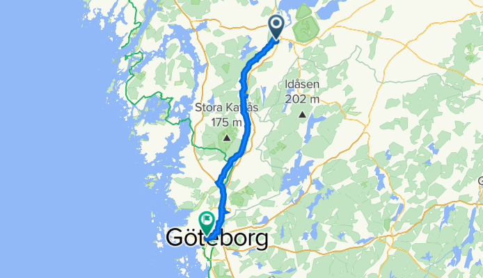
Vänern runt 11 Trollhättan - Göteborg
A cycling route starting in Trollhättan, Västra Götaland County, Sweden.
Overview
About this route
- -:--
- Duration
- 87.9 km
- Distance
- 248 m
- Ascent
- 274 m
- Descent
- ---
- Avg. speed
- ---
- Avg. speed
Route quality
Waytypes & surfaces along the route
Waytypes
Road
36.6 km
(42 %)
Path
33.5 km
(38 %)
Surfaces
Paved
69.5 km
(79 %)
Unpaved
7.1 km
(8 %)
Asphalt
62.1 km
(71 %)
Paved (undefined)
6.6 km
(8 %)
Continue with Bikemap
Use, edit, or download this cycling route
You would like to ride Vänern runt 11 Trollhättan - Göteborg or customize it for your own trip? Here is what you can do with this Bikemap route:
Free features
- Save this route as favorite or in collections
- Copy & plan your own version of this route
- Sync your route with Garmin or Wahoo
Premium features
Free trial for 3 days, or one-time payment. More about Bikemap Premium.
- Navigate this route on iOS & Android
- Export a GPX / KML file of this route
- Create your custom printout (try it for free)
- Download this route for offline navigation
Discover more Premium features.
Get Bikemap PremiumFrom our community
Other popular routes starting in Trollhättan
 Cracking ride in Trollhättan
- Distance
- 39.7 km
- Ascent
- 108 m
- Descent
- 130 m
- Location
- Trollhättan, Västra Götaland County, Sweden
 Wänerfof-linje
- Distance
- 27.6 km
- Ascent
- 160 m
- Descent
- 162 m
- Location
- Trollhättan, Västra Götaland County, Sweden
 9Trollhättan-Lidköping
- Distance
- 75.3 km
- Ascent
- 130 m
- Descent
- 127 m
- Location
- Trollhättan, Västra Götaland County, Sweden
 Trollhäötta Knorretorpsvägen nach Ursands badplats
- Distance
- 18.8 km
- Ascent
- 88 m
- Descent
- 89 m
- Location
- Trollhättan, Västra Götaland County, Sweden
 Polhemsgatan 6–8, Trollhättan to Centrum, Göteborg
- Distance
- 80.5 km
- Ascent
- 484 m
- Descent
- 526 m
- Location
- Trollhättan, Västra Götaland County, Sweden
 Linnéruten
- Distance
- 49.6 km
- Ascent
- 165 m
- Descent
- 165 m
- Location
- Trollhättan, Västra Götaland County, Sweden
 Trollhättan–Bohus via Ljungskile, Lilla Edet og Stenungsund
- Distance
- 141.5 km
- Ascent
- 1,896 m
- Descent
- 1,937 m
- Location
- Trollhättan, Västra Götaland County, Sweden
 Trollhätan -Lilla Edet
- Distance
- 23.4 km
- Ascent
- 200 m
- Descent
- 226 m
- Location
- Trollhättan, Västra Götaland County, Sweden
Open it in the app