
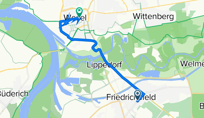
Spellener Straße 51, Voerde nach Hohe Straße 24–42, Wesel
A cycling route starting in Voerde, North Rhine-Westphalia, Germany.
Overview
About this route
- 1 h 2 min
- Duration
- 7.6 km
- Distance
- 91 m
- Ascent
- 89 m
- Descent
- 7.3 km/h
- Avg. speed
- 47 m
- Avg. speed

Continue with Bikemap
Use, edit, or download this cycling route
You would like to ride Spellener Straße 51, Voerde nach Hohe Straße 24–42, Wesel or customize it for your own trip? Here is what you can do with this Bikemap route:
Free features
- Save this route as favorite or in collections
- Copy & plan your own version of this route
- Sync your route with Garmin or Wahoo
Premium features
Free trial for 3 days, or one-time payment. More about Bikemap Premium.
- Navigate this route on iOS & Android
- Export a GPX / KML file of this route
- Create your custom printout (try it for free)
- Download this route for offline navigation
Discover more Premium features.
Get Bikemap PremiumFrom our community
Other popular routes starting in Voerde
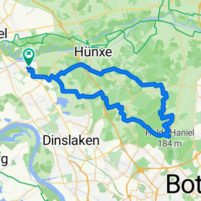
 Kleine Abendrunde
- Distance
- 41.9 km
- Ascent
- 89 m
- Descent
- 90 m
- Location
- Voerde, North Rhine-Westphalia, Germany
 Keer Tröch
- Distance
- 35.5 km
- Ascent
- 55 m
- Descent
- 55 m
- Location
- Voerde, North Rhine-Westphalia, Germany
 Marberts Grafenmühle-Tour 11.7.2010
- Distance
- 45.5 km
- Ascent
- 140 m
- Descent
- 140 m
- Location
- Voerde, North Rhine-Westphalia, Germany
 Parkstraße 11, Voerde (Niederrhein) nach Parkstraße 11, Voerde (Niederrhein)
- Distance
- 32.9 km
- Ascent
- 40 m
- Descent
- 85 m
- Location
- Voerde, North Rhine-Westphalia, Germany
 Grüne Halde
- Distance
- 32.2 km
- Ascent
- 168 m
- Descent
- 169 m
- Location
- Voerde, North Rhine-Westphalia, Germany
 Landschaftsschutzgebiete über Walsum Südhafen und Hoaglinie dann Mattlerbusch über Lohberg.
- Distance
- 49.9 km
- Ascent
- 201 m
- Descent
- 204 m
- Location
- Voerde, North Rhine-Westphalia, Germany
 Standardrunde ca. 30km
- Distance
- 29.2 km
- Ascent
- 65 m
- Descent
- 68 m
- Location
- Voerde, North Rhine-Westphalia, Germany
 NR204: Rotbach, Rhein und Kanal
- Distance
- 40.3 km
- Ascent
- 175 m
- Descent
- 175 m
- Location
- Voerde, North Rhine-Westphalia, Germany
Open it in the app