

Putevima prošlosti
A cycling route starting in Orašac, Federation of Bosnia and Herzegovina, Bosnia and Herzegovina.
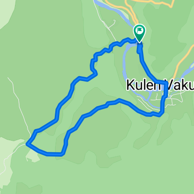
Overview
About this route
Staza je opremljena sa 11 poučnih tabli o kulturnoj baštini Nacionalnog parka i njegovih kontakt zona. Staza nije zahtjevna i prva dionica u dužini od 1km predstavlja uspon, a nakon toga nastavlja po kliševićkom platou koja vodi ka ruševinama kule Klišević, nakon koje staza lagano ide niz padinu sve do rijeke Une i samog lokaliteta slapova. Duž staze su postavljene i dvije nadstrešnice sa klupama i stolovima kako bi se posjetitelji mogli odmoriti. Staza je označena putokazima i planinarskim oznakama (markacijama).
- -:--
- Duration
- 4.8 km
- Distance
- 216 m
- Ascent
- 312 m
- Descent
- ---
- Avg. speed
- 604 m
- Avg. speed
Route quality
Waytypes & surfaces along the route
Waytypes
Path
3.3 km
(69 %)
Track
1 km
(21 %)
Surfaces
Unpaved
4.5 km
(94 %)
Ground
4 km
(84 %)
Loose gravel
0.5 km
(10 %)
Undefined
0.3 km
(6 %)
Route highlights
Points of interest along the route

Photo after 2.7 km
Kula Klišević
Continue with Bikemap
Use, edit, or download this cycling route
You would like to ride Putevima prošlosti or customize it for your own trip? Here is what you can do with this Bikemap route:
Free features
- Save this route as favorite or in collections
- Copy & plan your own version of this route
- Sync your route with Garmin or Wahoo
Premium features
Free trial for 3 days, or one-time payment. More about Bikemap Premium.
- Navigate this route on iOS & Android
- Export a GPX / KML file of this route
- Create your custom printout (try it for free)
- Download this route for offline navigation
Discover more Premium features.
Get Bikemap PremiumFrom our community
Other popular routes starting in Orašac
 Martin Brod - Kulen Vakuf - Kamp ispred Bihaća
- Distance
- 49 km
- Ascent
- 547 m
- Descent
- 686 m
- Location
- Orašac, Federation of Bosnia and Herzegovina, Bosnia and Herzegovina
 KULEN VAKUF - BIHAĆ TAPPA 3
- Distance
- 44.9 km
- Ascent
- 603 m
- Descent
- 439 m
- Location
- Orašac, Federation of Bosnia and Herzegovina, Bosnia and Herzegovina
 4 den 2/2
- Distance
- 43.8 km
- Ascent
- 681 m
- Descent
- 804 m
- Location
- Orašac, Federation of Bosnia and Herzegovina, Bosnia and Herzegovina
 Urni team spring 20 day 2 Bihač- Vodice
- Distance
- 167.9 km
- Ascent
- 1,384 m
- Descent
- 1,866 m
- Location
- Orašac, Federation of Bosnia and Herzegovina, Bosnia and Herzegovina
 SEFF 2019.
- Distance
- 425.3 km
- Ascent
- 946 m
- Descent
- 1,130 m
- Location
- Orašac, Federation of Bosnia and Herzegovina, Bosnia and Herzegovina
 Dag 238 (slutet)
- Distance
- 37.4 km
- Ascent
- 457 m
- Descent
- 524 m
- Location
- Orašac, Federation of Bosnia and Herzegovina, Bosnia and Herzegovina
 Bosnia Cicloturistica 1.1
- Distance
- 610.7 km
- Ascent
- 1,139 m
- Descent
- 1,415 m
- Location
- Orašac, Federation of Bosnia and Herzegovina, Bosnia and Herzegovina
 Ostrovica
- Distance
- 7.4 km
- Ascent
- 198 m
- Descent
- 197 m
- Location
- Orašac, Federation of Bosnia and Herzegovina, Bosnia and Herzegovina
Open it in the app