

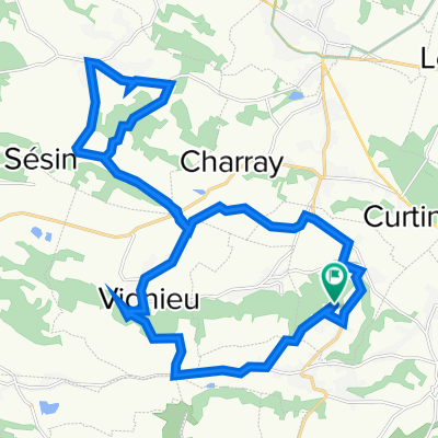
Groslée - Evieu
A cycling route starting in Curtin, Auvergne-Rhône-Alpes, France.
Overview
About this route
- 2 h 16 min
- Duration
- 35.4 km
- Distance
- 368 m
- Ascent
- 251 m
- Descent
- 15.6 km/h
- Avg. speed
- 406 m
- Avg. speed

Route quality
Waytypes & surfaces along the route
Waytypes
Road
13.4 km
(38 %)
Quiet road
13.3 km
(38 %)
Surfaces
Paved
7.6 km
(22 %)
Unpaved
0.1 km
(<1 %)
Asphalt
7.6 km
(21 %)
Gravel
0.1 km
(<1 %)
Continue with Bikemap
Use, edit, or download this cycling route
You would like to ride Groslée - Evieu or customize it for your own trip? Here is what you can do with this Bikemap route:
Free features
- Save this route as favorite or in collections
- Copy & plan your own version of this route
- Sync your route with Garmin or Wahoo
Premium features
Free trial for 3 days, or one-time payment. More about Bikemap Premium.
- Navigate this route on iOS & Android
- Export a GPX / KML file of this route
- Create your custom printout (try it for free)
- Download this route for offline navigation
Discover more Premium features.
Get Bikemap PremiumFrom our community
Other popular routes starting in Curtin
 Vézeronce-Curtin à 21 Route des Alpes, Sablons
- Distance
- 95.8 km
- Ascent
- 538 m
- Descent
- 611 m
- Location
- Curtin, Auvergne-Rhône-Alpes, France
 Sermerieux
- Distance
- 27.5 km
- Ascent
- 434 m
- Descent
- 436 m
- Location
- Curtin, Auvergne-Rhône-Alpes, France
 saint chef
- Distance
- 23.7 km
- Ascent
- 330 m
- Descent
- 328 m
- Location
- Curtin, Auvergne-Rhône-Alpes, France
 220 Rue Saint-Martin, Vézeronce-Curtin à 220 Rue Saint-Martin, Vézeronce-Curtin
- Distance
- 10.5 km
- Ascent
- 245 m
- Descent
- 250 m
- Location
- Curtin, Auvergne-Rhône-Alpes, France
 688 Route de Morestel, Vézeronce-Curtin à 220 Rue Saint-Martin, Vézeronce-Curtin
- Distance
- 14.6 km
- Ascent
- 342 m
- Descent
- 320 m
- Location
- Curtin, Auvergne-Rhône-Alpes, France
 Rochetoirin
- Distance
- 25.7 km
- Ascent
- 352 m
- Descent
- 301 m
- Location
- Curtin, Auvergne-Rhône-Alpes, France
 Bas Cuirieu
- Distance
- 32.7 km
- Ascent
- 409 m
- Descent
- 410 m
- Location
- Curtin, Auvergne-Rhône-Alpes, France
 Briprd
- Distance
- 50.6 km
- Ascent
- 396 m
- Descent
- 394 m
- Location
- Curtin, Auvergne-Rhône-Alpes, France
Open it in the app