

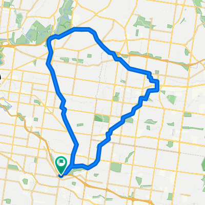
East Malvern to Syndal
A cycling route starting in Carnegie, Victoria, Australia.
Overview
About this route
Via Garinders Creek and Syndal-Heatherdale Pipe Reserve Trails
- -:--
- Duration
- 21.6 km
- Distance
- 192 m
- Ascent
- 115 m
- Descent
- ---
- Avg. speed
- 137 m
- Avg. speed

Route quality
Waytypes & surfaces along the route
Waytypes
Cycleway
15.6 km
(73 %)
Quiet road
3 km
(14 %)
Surfaces
Paved
12.5 km
(58 %)
Unpaved
5.4 km
(25 %)
Asphalt
6.1 km
(28 %)
Concrete
5.4 km
(25 %)
Continue with Bikemap
Use, edit, or download this cycling route
You would like to ride East Malvern to Syndal or customize it for your own trip? Here is what you can do with this Bikemap route:
Free features
- Save this route as favorite or in collections
- Copy & plan your own version of this route
- Sync your route with Garmin or Wahoo
Premium features
Free trial for 3 days, or one-time payment. More about Bikemap Premium.
- Navigate this route on iOS & Android
- Export a GPX / KML file of this route
- Create your custom printout (try it for free)
- Download this route for offline navigation
Discover more Premium features.
Get Bikemap PremiumFrom our community
Other popular routes starting in Carnegie
 Train_Wayne
- Distance
- 5.2 km
- Ascent
- 20 m
- Descent
- 5 m
- Location
- Carnegie, Victoria, Australia
 First Ride E Malvern To City
- Distance
- 18.6 km
- Ascent
- 112 m
- Descent
- 112 m
- Location
- Carnegie, Victoria, Australia
 Recording from 9 Mar 2016, 7:51 AM
- Distance
- 16.6 km
- Ascent
- 100 m
- Descent
- 81 m
- Location
- Carnegie, Victoria, Australia
 Carnegie to Monash Medical Centre
- Distance
- 7.1 km
- Ascent
- 31 m
- Descent
- 8 m
- Location
- Carnegie, Victoria, Australia
 Rusty Ride V2
- Distance
- 87.2 km
- Ascent
- 279 m
- Descent
- 279 m
- Location
- Carnegie, Victoria, Australia
 Elwood via Scotsmans Ckeek
- Distance
- 14.5 km
- Ascent
- 36 m
- Descent
- 62 m
- Location
- Carnegie, Victoria, Australia
 East Malvern. Blackburn, Ivanhoe & return
- Distance
- 36.2 km
- Ascent
- 179 m
- Descent
- 178 m
- Location
- Carnegie, Victoria, Australia
 Anniversary Trail - Capital City - Sandridge Rail Trail - Bay Trail - Long Beach Trail -Dandenong Creek - East Link Trail - Djerring Trail
- Distance
- 100 km
- Ascent
- 529 m
- Descent
- 531 m
- Location
- Carnegie, Victoria, Australia
Open it in the app