

Kottenforst Ville-Seen
A cycling route starting in Neustadt/Nord, North Rhine-Westphalia, Germany.
Overview
About this route
Villeseen_Naturschutzgebiet
Länge: 60 km Hans-Böckler-Platz Wst-Bahnhof Die Radtour startet am Grüngürtel und führt durch den RegioGrün Südwest Korridor. “Zu den Villeseen“. Durch der abwechslungsreiche Naturpark Radeln wir um die VilleSeen; der Köttinger-See, Bleibtreusee, Heder-Bergersee, Franziskussee, Liblarer-See Obersee, Untersee. Über Brühl, zurück nach Köln.- -:--
- Duration
- 60.3 km
- Distance
- 175 m
- Ascent
- 180 m
- Descent
- ---
- Avg. speed
- ---
- Avg. speed

Route quality
Waytypes & surfaces along the route
Waytypes
Path
19.4 km
(32 %)
Track
18.3 km
(30 %)
Surfaces
Paved
32.1 km
(53 %)
Unpaved
23.9 km
(40 %)
Asphalt
26.1 km
(43 %)
Gravel
16.8 km
(28 %)
Route highlights
Points of interest along the route

Photo after 18.7 km
Köttinger See

Photo after 21.9 km
Albertsee

Photo after 25.5 km
Bleibtreusee in Brühl

Photo after 26.7 km
Heiderbergsee

Photo after 31 km
Franziskus-See

Photo after 32.6 km
Liblarer See

Point of interest after 33.6 km
Ville Express Max-Planck-Strasse 1, 50374 Erftstadt 02235 922992 Di - Sa: 18:00 - 1:00 So: 12:00 - 1:00

Photo after 36.4 km
Obersee, Kottenforst Ville

Photo after 38.1 km
Untersee
Continue with Bikemap
Use, edit, or download this cycling route
You would like to ride Kottenforst Ville-Seen or customize it for your own trip? Here is what you can do with this Bikemap route:
Free features
- Save this route as favorite or in collections
- Copy & plan your own version of this route
- Sync your route with Garmin or Wahoo
Premium features
Free trial for 3 days, or one-time payment. More about Bikemap Premium.
- Navigate this route on iOS & Android
- Export a GPX / KML file of this route
- Create your custom printout (try it for free)
- Download this route for offline navigation
Discover more Premium features.
Get Bikemap PremiumFrom our community
Other popular routes starting in Neustadt/Nord
 Stommeln Windmühlen
- Distance
- 60.3 km
- Ascent
- 85 m
- Descent
- 83 m
- Location
- Neustadt/Nord, North Rhine-Westphalia, Germany
 Route nach Arnhem
- Distance
- 173.9 km
- Ascent
- 278 m
- Descent
- 321 m
- Location
- Neustadt/Nord, North Rhine-Westphalia, Germany
 Mediapark bis zum Kloster Knechtsteden
- Distance
- 40.9 km
- Ascent
- 77 m
- Descent
- 90 m
- Location
- Neustadt/Nord, North Rhine-Westphalia, Germany
 Blumenthalstraße - Fühlinger See
- Distance
- 33.7 km
- Ascent
- 96 m
- Descent
- 135 m
- Location
- Neustadt/Nord, North Rhine-Westphalia, Germany
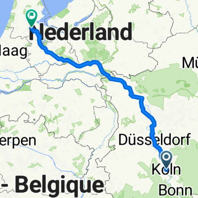 Kuln Amsterdam
- Distance
- 292.4 km
- Ascent
- 97 m
- Descent
- 149 m
- Location
- Neustadt/Nord, North Rhine-Westphalia, Germany
 Kottenforst Ville-Seen Radweg
- Distance
- 60.3 km
- Ascent
- 177 m
- Descent
- 184 m
- Location
- Neustadt/Nord, North Rhine-Westphalia, Germany
 Kölnrunde
- Distance
- 34.3 km
- Ascent
- 115 m
- Descent
- 112 m
- Location
- Neustadt/Nord, North Rhine-Westphalia, Germany
 Schloßpark Dyck
- Distance
- 64.1 km
- Ascent
- 112 m
- Descent
- 115 m
- Location
- Neustadt/Nord, North Rhine-Westphalia, Germany
Open it in the app