

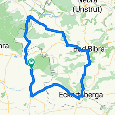
Rastenberg (55km)- Kölleda-Buttstädt-Gebstedt-Eßleben-Rastenberg
A cycling route starting in Rastenberg, Free State of Thuringia, Germany.
Overview
About this route
- -:--
- Duration
- 55.9 km
- Distance
- 297 m
- Ascent
- 298 m
- Descent
- ---
- Avg. speed
- 259 m
- Avg. speed

Route quality
Waytypes & surfaces along the route
Waytypes
Busy road
17.9 km
(32 %)
Road
12.9 km
(23 %)
Surfaces
Paved
40.1 km
(72 %)
Unpaved
0 km
(<1 %)
Asphalt
34.4 km
(62 %)
Concrete
2.6 km
(5 %)
Continue with Bikemap
Use, edit, or download this cycling route
You would like to ride Rastenberg (55km)- Kölleda-Buttstädt-Gebstedt-Eßleben-Rastenberg or customize it for your own trip? Here is what you can do with this Bikemap route:
Free features
- Save this route as favorite or in collections
- Copy & plan your own version of this route
- Sync your route with Garmin or Wahoo
Premium features
Free trial for 3 days, or one-time payment. More about Bikemap Premium.
- Navigate this route on iOS & Android
- Export a GPX / KML file of this route
- Create your custom printout (try it for free)
- Download this route for offline navigation
Discover more Premium features.
Get Bikemap PremiumFrom our community
Other popular routes starting in Rastenberg
 Rastenberg-Freyburg-Rastenberg
- Distance
- 79.3 km
- Ascent
- 533 m
- Descent
- 531 m
- Location
- Rastenberg, Free State of Thuringia, Germany
 Rund um die Finne
- Distance
- 60.3 km
- Ascent
- 411 m
- Descent
- 386 m
- Location
- Rastenberg, Free State of Thuringia, Germany
 Rastenberg 30km- Lossa-Tauhardt-Eßleben-Rastenberg
- Distance
- 29.9 km
- Ascent
- 293 m
- Descent
- 295 m
- Location
- Rastenberg, Free State of Thuringia, Germany
 weimartour
- Distance
- 26.2 km
- Ascent
- 236 m
- Descent
- 222 m
- Location
- Rastenberg, Free State of Thuringia, Germany
 Von der Finne an die Ilm
- Distance
- 97.7 km
- Ascent
- 774 m
- Descent
- 792 m
- Location
- Rastenberg, Free State of Thuringia, Germany
 Rastenberg - Leutenthal - Rastenberg
- Distance
- 48.3 km
- Ascent
- 310 m
- Descent
- 310 m
- Location
- Rastenberg, Free State of Thuringia, Germany
 Mühltal 1A, Rastenberg nach Dorfstraße 71, Buchholz
- Distance
- 360 km
- Ascent
- 1,378 m
- Descent
- 1,519 m
- Location
- Rastenberg, Free State of Thuringia, Germany
 Feierabendrunde um die Fnne
- Distance
- 48.8 km
- Ascent
- 343 m
- Descent
- 286 m
- Location
- Rastenberg, Free State of Thuringia, Germany
Open it in the app