
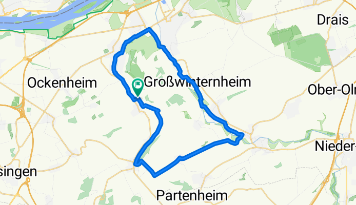
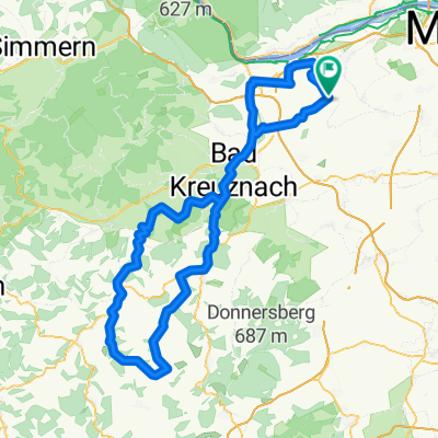
Welzbach - Selztal Runde
A cycling route starting in Appenheim, Rhineland-Palatinate, Germany.
Overview
About this route
sehr schöne, relativ ruhige Radwege. Eine Strecke von ca. 3 Km jedoch mit Schotter, einige hundert Meter unbefestigter Waldweg (nix für Rennrad)
- -:--
- Duration
- 27.5 km
- Distance
- 133 m
- Ascent
- 185 m
- Descent
- ---
- Avg. speed
- 257 m
- Avg. speed
Route quality
Waytypes & surfaces along the route
Waytypes
Track
17.1 km
(62 %)
Quiet road
5 km
(18 %)
Surfaces
Paved
20.5 km
(75 %)
Unpaved
2.9 km
(11 %)
Asphalt
15 km
(55 %)
Paved (undefined)
4.9 km
(18 %)
Continue with Bikemap
Use, edit, or download this cycling route
You would like to ride Welzbach - Selztal Runde or customize it for your own trip? Here is what you can do with this Bikemap route:
Free features
- Save this route as favorite or in collections
- Copy & plan your own version of this route
- Sync your route with Garmin or Wahoo
Premium features
Free trial for 3 days, or one-time payment. More about Bikemap Premium.
- Navigate this route on iOS & Android
- Export a GPX / KML file of this route
- Create your custom printout (try it for free)
- Download this route for offline navigation
Discover more Premium features.
Get Bikemap PremiumFrom our community
Other popular routes starting in Appenheim
 048d: Ingelheim - Gensingen - Hergenfeld - Schöneberg - Trollbachtal - Ingelheim
- Distance
- 64 km
- Ascent
- 561 m
- Descent
- 561 m
- Location
- Appenheim, Rhineland-Palatinate, Germany
 Flonheimrunde
- Distance
- 51.8 km
- Ascent
- 344 m
- Descent
- 342 m
- Location
- Appenheim, Rhineland-Palatinate, Germany
 048c: Ingelheim - Gensingen - Dalberg - Schöneberg - Trollbachtal - Ingelheim
- Distance
- 70.6 km
- Ascent
- 630 m
- Descent
- 630 m
- Location
- Appenheim, Rhineland-Palatinate, Germany
 048a: Ingelheim - Gensingen - Allenfeld - Spall - Schöneberg - Trollbachtal - Ingelheim
- Distance
- 81.2 km
- Ascent
- 682 m
- Descent
- 680 m
- Location
- Appenheim, Rhineland-Palatinate, Germany
 048j: Ingelheim - Gensingen - Windesheim - Trollbachtal - Ingelheim
- Distance
- 54.6 km
- Ascent
- 402 m
- Descent
- 402 m
- Location
- Appenheim, Rhineland-Palatinate, Germany
 Rund um den Laurenziberg
- Distance
- 21.7 km
- Ascent
- 150 m
- Descent
- 191 m
- Location
- Appenheim, Rhineland-Palatinate, Germany
 3 Täler Tour
- Distance
- 131.8 km
- Ascent
- 674 m
- Descent
- 675 m
- Location
- Appenheim, Rhineland-Palatinate, Germany
 Bad Münster Tour
- Distance
- 59.2 km
- Ascent
- 595 m
- Descent
- 596 m
- Location
- Appenheim, Rhineland-Palatinate, Germany
Open it in the app