

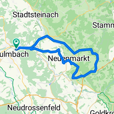
Kulmbach Schorgasttal Steinachklamm Kulmbach
A cycling route starting in Kulmbach, Bavaria, Germany.
Overview
About this route
Route durch zwei sehr schöne Bachtäler im Frankenwald und das Geotop Steinachklamm. Anstieg beständig aber kaum einmal steil. Schöne Ausblicke auf Frankenwald und Fichtelgebirge. Strecke größtenteils auf asphaltiereten Radwegen, im Schorgast- und Steinachtal Waldboden oder Schotter (insgesamt rund 15km).
- -:--
- Duration
- 55.9 km
- Distance
- 767 m
- Ascent
- 764 m
- Descent
- ---
- Avg. speed
- 592 m
- Avg. speed

Route photos


Route quality
Waytypes & surfaces along the route
Waytypes
Quiet road
22.6 km
(40 %)
Cycleway
15.5 km
(28 %)
Surfaces
Paved
29.2 km
(52 %)
Unpaved
9.9 km
(18 %)
Asphalt
27.5 km
(49 %)
Gravel
8.5 km
(15 %)
Continue with Bikemap
Use, edit, or download this cycling route
You would like to ride Kulmbach Schorgasttal Steinachklamm Kulmbach or customize it for your own trip? Here is what you can do with this Bikemap route:
Free features
- Save this route as favorite or in collections
- Copy & plan your own version of this route
- Sync your route with Garmin or Wahoo
Premium features
Free trial for 3 days, or one-time payment. More about Bikemap Premium.
- Navigate this route on iOS & Android
- Export a GPX / KML file of this route
- Create your custom printout (try it for free)
- Download this route for offline navigation
Discover more Premium features.
Get Bikemap PremiumFrom our community
Other popular routes starting in Kulmbach
 Kulmbach Wirsberg Hermes Kulmbach
- Distance
- 49.1 km
- Ascent
- 698 m
- Descent
- 695 m
- Location
- Kulmbach, Bavaria, Germany
 2017_05 Wickenreuth E-Bike-Tour
- Distance
- 37.3 km
- Ascent
- 443 m
- Descent
- 443 m
- Location
- Kulmbach, Bavaria, Germany
 Kulm Wirsb Himmelskron Neumarkt
- Distance
- 42.5 km
- Ascent
- 522 m
- Descent
- 522 m
- Location
- Kulmbach, Bavaria, Germany
 Kulmbach-Achter
- Distance
- 85.6 km
- Ascent
- 777 m
- Descent
- 696 m
- Location
- Kulmbach, Bavaria, Germany
 Rundweg Kulmbach - Wirsberg - Kulmbach
- Distance
- 31.3 km
- Ascent
- 130 m
- Descent
- 129 m
- Location
- Kulmbach, Bavaria, Germany
 Schorgasttal-Weißmaintal-Runde
- Distance
- 31.4 km
- Ascent
- 118 m
- Descent
- 116 m
- Location
- Kulmbach, Bavaria, Germany
 Kulmbach - anspruchsvolle Runde
- Distance
- 92.3 km
- Ascent
- 1,110 m
- Descent
- 1,060 m
- Location
- Kulmbach, Bavaria, Germany
 Kulmbach - Mainleus- Frankenberg - Kulmbach
- Distance
- 19.5 km
- Ascent
- 128 m
- Descent
- 134 m
- Location
- Kulmbach, Bavaria, Germany
Open it in the app