

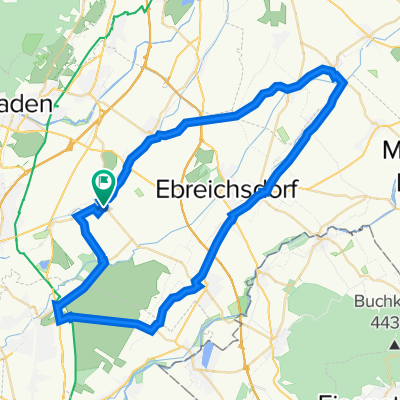
Pottendorf nach Wiener Neustädter Straße 34a, Ebreichsdorf
A cycling route starting in Tattendorf, Lower Austria, Austria.
Overview
About this route
- 25 min
- Duration
- 7.4 km
- Distance
- 12 m
- Ascent
- 31 m
- Descent
- 18.2 km/h
- Avg. speed
- 221 m
- Avg. speed
Route quality
Waytypes & surfaces along the route
Waytypes
Track
3.4 km
(46 %)
Quiet road
2.3 km
(31 %)
Surfaces
Paved
4.2 km
(57 %)
Unpaved
2.8 km
(38 %)
Asphalt
4.2 km
(56 %)
Gravel
2.8 km
(38 %)
Continue with Bikemap
Use, edit, or download this cycling route
You would like to ride Pottendorf nach Wiener Neustädter Straße 34a, Ebreichsdorf or customize it for your own trip? Here is what you can do with this Bikemap route:
Free features
- Save this route as favorite or in collections
- Copy & plan your own version of this route
- Sync your route with Garmin or Wahoo
Premium features
Free trial for 3 days, or one-time payment. More about Bikemap Premium.
- Navigate this route on iOS & Android
- Export a GPX / KML file of this route
- Create your custom printout (try it for free)
- Download this route for offline navigation
Discover more Premium features.
Get Bikemap PremiumFrom our community
Other popular routes starting in Tattendorf
 Weinroute
- Distance
- 45.2 km
- Ascent
- 124 m
- Descent
- 116 m
- Location
- Tattendorf, Lower Austria, Austria
 Ingenieur Julius Raab Straße 1, Tattendorf nach Johann-Böhm-Straße 13, Kottingbrunn
- Distance
- 11.4 km
- Ascent
- 51 m
- Descent
- 66 m
- Location
- Tattendorf, Lower Austria, Austria
 Ingenieur Julius Raab Straße 1, Tattendorf nach Johann-Böhm-Straße 13, Kottingbrunn
- Distance
- 10.6 km
- Ascent
- 46 m
- Descent
- 14 m
- Location
- Tattendorf, Lower Austria, Austria
 Helenental Landegg 74
- Distance
- 59 km
- Ascent
- 324 m
- Descent
- 369 m
- Location
- Tattendorf, Lower Austria, Austria
 Sollenauerstraße 1, Blumau nach Unnamed Road
- Distance
- 6.8 km
- Ascent
- 5 m
- Descent
- 25 m
- Location
- Tattendorf, Lower Austria, Austria
 Pottendorfer Straße 4, Tattendorf nach Eisenstädter Straße 10, Wimpassing an der Leitha
- Distance
- 12.7 km
- Ascent
- 8 m
- Descent
- 27 m
- Location
- Tattendorf, Lower Austria, Austria
 RR_55km
- Distance
- 55.4 km
- Ascent
- 88 m
- Descent
- 88 m
- Location
- Tattendorf, Lower Austria, Austria
 Baden 1
- Distance
- 118 km
- Ascent
- 1,391 m
- Descent
- 1,394 m
- Location
- Tattendorf, Lower Austria, Austria
Open it in the app