

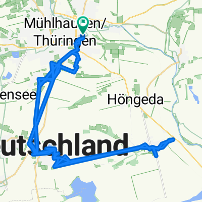
51.206° N 10.414° W nach 51.168° N 10.337° W
A cycling route starting in Mühlhausen, Free State of Thuringia, Germany.
Overview
About this route
- 1 h 45 min
- Duration
- 16.2 km
- Distance
- 314 m
- Ascent
- 140 m
- Descent
- 9.2 km/h
- Avg. speed
- 466 m
- Avg. speed

Route quality
Waytypes & surfaces along the route
Waytypes
Track
13.9 km
(86 %)
Busy road
0.8 km
(5 %)
Surfaces
Paved
1.6 km
(10 %)
Unpaved
14.1 km
(87 %)
Gravel
13 km
(80 %)
Asphalt
1 km
(6 %)
Continue with Bikemap
Use, edit, or download this cycling route
You would like to ride 51.206° N 10.414° W nach 51.168° N 10.337° W or customize it for your own trip? Here is what you can do with this Bikemap route:
Free features
- Save this route as favorite or in collections
- Copy & plan your own version of this route
- Sync your route with Garmin or Wahoo
Premium features
Free trial for 3 days, or one-time payment. More about Bikemap Premium.
- Navigate this route on iOS & Android
- Export a GPX / KML file of this route
- Create your custom printout (try it for free)
- Download this route for offline navigation
Discover more Premium features.
Get Bikemap PremiumFrom our community
Other popular routes starting in Mühlhausen
 Wahlstraße, Mühlhausen/Thüringen to Rückermainstraße, Würzburg
- Distance
- 250.3 km
- Ascent
- 2,550 m
- Descent
- 2,592 m
- Location
- Mühlhausen, Free State of Thuringia, Germany
 2025-05-11_Mühlhausen-Unstrut-Urbich
- Distance
- 75 km
- Ascent
- 262 m
- Descent
- 237 m
- Location
- Mühlhausen, Free State of Thuringia, Germany
 2017-10-14: 4. WE-Tour Unstrut-Leine-Werra-Unstrut
- Distance
- 151.6 km
- Ascent
- 676 m
- Descent
- 674 m
- Location
- Mühlhausen, Free State of Thuringia, Germany
 UHW 002: Mühlhausen/Thür. - Wolfsbrunnen über Berka v. d. Hainich
- Distance
- 109.3 km
- Ascent
- 881 m
- Descent
- 861 m
- Location
- Mühlhausen, Free State of Thuringia, Germany
 gemütliche Tour UH
- Distance
- 43.1 km
- Ascent
- 73 m
- Descent
- 69 m
- Location
- Mühlhausen, Free State of Thuringia, Germany
 Felchta I
- Distance
- 23.5 km
- Ascent
- 121 m
- Descent
- 114 m
- Location
- Mühlhausen, Free State of Thuringia, Germany
 Wahlstraße, Mühlhausen/Thüringen to Rückermainstraße, Würzburg
- Distance
- 244.7 km
- Ascent
- 2,068 m
- Descent
- 2,112 m
- Location
- Mühlhausen, Free State of Thuringia, Germany
 2017-10-14: Mühlhausen - Heiligenstadt - Bad Sooden
- Distance
- 78 km
- Ascent
- 497 m
- Descent
- 548 m
- Location
- Mühlhausen, Free State of Thuringia, Germany
Open it in the app