

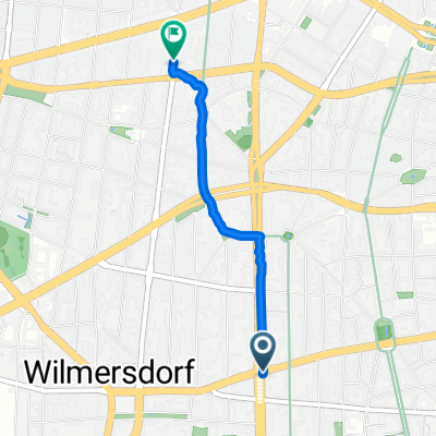
52.494° N 13.322° W to Katzbachstraße 27, Berlin
A cycling route starting in Wilmersdorf, Land Berlin, Germany.
Overview
About this route
- 26 min
- Duration
- 5 km
- Distance
- 60 m
- Ascent
- 49 m
- Descent
- 11.4 km/h
- Avg. speed
- 80 m
- Avg. speed
Route quality
Waytypes & surfaces along the route
Waytypes
Quiet road
1.6 km
(33 %)
Pedestrian area
1.5 km
(30 %)
Surfaces
Paved
4.6 km
(92 %)
Asphalt
3.5 km
(71 %)
Paving stones
1.1 km
(22 %)
Undefined
0.4 km
(8 %)
Continue with Bikemap
Use, edit, or download this cycling route
You would like to ride 52.494° N 13.322° W to Katzbachstraße 27, Berlin or customize it for your own trip? Here is what you can do with this Bikemap route:
Free features
- Save this route as favorite or in collections
- Copy & plan your own version of this route
- Sync your route with Garmin or Wahoo
Premium features
Free trial for 3 days, or one-time payment. More about Bikemap Premium.
- Navigate this route on iOS & Android
- Export a GPX / KML file of this route
- Create your custom printout (try it for free)
- Download this route for offline navigation
Discover more Premium features.
Get Bikemap PremiumFrom our community
Other popular routes starting in Wilmersdorf
 Bundesallee 178, Berlin nach Uhlandstraße 31, Berlin
- Distance
- 1.8 km
- Ascent
- 34 m
- Descent
- 41 m
- Location
- Wilmersdorf, Land Berlin, Germany
 Grunewald Tour (30km)
- Distance
- 31.5 km
- Ascent
- 158 m
- Descent
- 155 m
- Location
- Wilmersdorf, Land Berlin, Germany
 Berlin Leuchtet 2014
- Distance
- 23.1 km
- Ascent
- 76 m
- Descent
- 76 m
- Location
- Wilmersdorf, Land Berlin, Germany
 S/U Bundesplatz -> Ruhlsdorf -> Genshagen -> Zossen -> Mittenwalde -> Tollkrug -> S Lichtenrade -> S Südkreuz
- Distance
- 86.7 km
- Ascent
- 111 m
- Descent
- 116 m
- Location
- Wilmersdorf, Land Berlin, Germany
 Blankenseer Runde
- Distance
- 96.8 km
- Ascent
- 152 m
- Descent
- 152 m
- Location
- Wilmersdorf, Land Berlin, Germany
 S/U Bundesplatz -> Ruhlsdorf -> Genshagen -> Zossen -> Mittenwalde -> Tollkrug -> S Lichtenrade -> S Südkreuz
- Distance
- 86.6 km
- Ascent
- 180 m
- Descent
- 183 m
- Location
- Wilmersdorf, Land Berlin, Germany
 Grunewald erweitert
- Distance
- 56.4 km
- Ascent
- 273 m
- Descent
- 274 m
- Location
- Wilmersdorf, Land Berlin, Germany
 Berlin-Ketzin-Berlin
- Distance
- 94.6 km
- Ascent
- 185 m
- Descent
- 185 m
- Location
- Wilmersdorf, Land Berlin, Germany
Open it in the app