

Alpine Gravel - Tonale
A cycling route starting in Ossana, Trentino-Alto Adige, Italy.
Overview
About this route
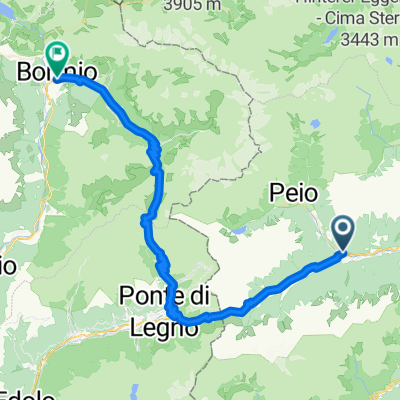
Starting from Ossana, we alternate between stretches on beaten ground, dirt roads, meadows and forest roads (a really varied panorama and terrain) until we reach the Tonale pass. A well-deserved break and after a short final climb, the long descent begins on stones and beaten earth that takes you back to Ossana. A minimum of technique is required to hold the bike, as the surface is sometimes uneven but always rideable without too much difficulty. Worthy of note are the various forts in the surrounding of the descent, which date back to the First World War.
- -:--
- Duration
- 36.1 km
- Distance
- 1,024 m
- Ascent
- 1,049 m
- Descent
- ---
- Avg. speed
- 1,975 m
- Avg. speed

Route photos


Route quality
Waytypes & surfaces along the route
Waytypes
Track
20.1 km
(56 %)
Quiet road
8.6 km
(24 %)
Surfaces
Paved
7.3 km
(20 %)
Unpaved
23.2 km
(64 %)
Unpaved (undefined)
10.5 km
(29 %)
Gravel
8.3 km
(23 %)
Continue with Bikemap
Use, edit, or download this cycling route
You would like to ride Alpine Gravel - Tonale or customize it for your own trip? Here is what you can do with this Bikemap route:
Free features
- Save this route as favorite or in collections
- Copy & plan your own version of this route
- Sync your route with Garmin or Wahoo
Premium features
Free trial for 3 days, or one-time payment. More about Bikemap Premium.
- Navigate this route on iOS & Android
- Export a GPX / KML file of this route
- Create your custom printout (try it for free)
- Download this route for offline navigation
Discover more Premium features.
Get Bikemap PremiumFrom our community
Other popular routes starting in Ossana
 Ossana - Caldes
- Distance
- 42.2 km
- Ascent
- 588 m
- Descent
- 593 m
- Location
- Ossana, Trentino-Alto Adige, Italy
 Alpencross 2010 | Etappe 7
- Distance
- 67.3 km
- Ascent
- 2,594 m
- Descent
- 3,001 m
- Location
- Ossana, Trentino-Alto Adige, Italy
 Val di Sole - Ossana Caldes
- Distance
- 42.8 km
- Ascent
- 387 m
- Descent
- 388 m
- Location
- Ossana, Trentino-Alto Adige, Italy
 Epic Trail Grande Guerra - MowiBike
- Distance
- 59.4 km
- Ascent
- 0 m
- Descent
- 0 m
- Location
- Ossana, Trentino-Alto Adige, Italy
 Val di Sole Ossana - Caldes
- Distance
- 41.7 km
- Ascent
- 385 m
- Descent
- 389 m
- Location
- Ossana, Trentino-Alto Adige, Italy
 Dag 3
Dag 3- Distance
- 70.5 km
- Ascent
- 2,007 m
- Descent
- 2,330 m
- Location
- Ossana, Trentino-Alto Adige, Italy
 Ossana - Tonalle - Gavia - Bormio
- Distance
- 67.2 km
- Ascent
- 2,268 m
- Descent
- 2,024 m
- Location
- Ossana, Trentino-Alto Adige, Italy
 Abzweig Osanna-Begflanke-Merilleva-Madonna
- Distance
- 39.5 km
- Ascent
- 2,434 m
- Descent
- 1,875 m
- Location
- Ossana, Trentino-Alto Adige, Italy
Open it in the app