Premium Badge Download on the App Store Get it on Google Play Turn-by-turn Navigation Offline Maps Bike Type Optimized Routing Premium Maps Custom Bike Computer Export Routes Route Previews Fall Detection Premium Support

Cycling Route in Cambridge, England, United Kingdom

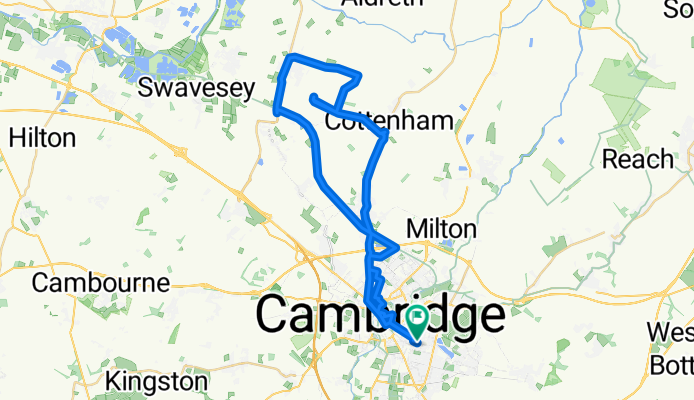
Numbing loop to Belsars Hill, Willingham

1
Open this route in the Bikemap app

Open this route in the Bikemap app

Open this route in Bikemap Web

Open this route in Bikemap Web

42 km
Distance
46 m
Ascent
46 m
Descent
-:-- h
Duration
-- km/h
Avg. Speed
--- m
Max. Elevation

About This Route

Cow Lane to Priest Lane is awful, concrete slab paving with tarmac slapped on later, and deep cracks between the slabs every 5 m or so, for ~3 miles. No fun on a road bike.  The tarmac surface along the new Guided Bus is very smooth (for now), almost like tarmac in the developed world (read: on the Continent), but this following what ws once a railroad it is mindnumbingly boring.

You will cycle on the following surfaces: Paved

Customize this cycling route with the Bikemap route planner.

Make it yours!

Did you know? You can use this route as a template in our cycling route planner if you don't wish to start from scratch. Customize it based on your needs to plan your perfect cycling tour.

Open it in the app