

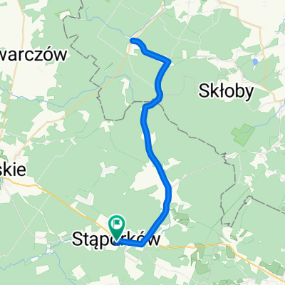
Gustawów - Odrowąż - Stąporków - Adamek - Gustawów
A cycling route starting in Gmina Stąporków, Świętokrzyskie Voivodship, Poland.
Overview
About this route
- -:--
- Duration
- 37 km
- Distance
- 337 m
- Ascent
- 337 m
- Descent
- ---
- Avg. speed
- ---
- Avg. speed

Route quality
Waytypes & surfaces along the route
Waytypes
Road
16.5 km
(45 %)
Quiet road
9.6 km
(26 %)
Surfaces
Paved
24.4 km
(66 %)
Unpaved
1.6 km
(4 %)
Asphalt
24.4 km
(66 %)
Gravel
1 km
(3 %)
Continue with Bikemap
Use, edit, or download this cycling route
You would like to ride Gustawów - Odrowąż - Stąporków - Adamek - Gustawów or customize it for your own trip? Here is what you can do with this Bikemap route:
Free features
- Save this route as favorite or in collections
- Copy & plan your own version of this route
- Sync your route with Garmin or Wahoo
Premium features
Free trial for 3 days, or one-time payment. More about Bikemap Premium.
- Navigate this route on iOS & Android
- Export a GPX / KML file of this route
- Create your custom printout (try it for free)
- Download this route for offline navigation
Discover more Premium features.
Get Bikemap PremiumFrom our community
Other popular routes starting in Gmina Stąporków
 ruski bród
- Distance
- 47.2 km
- Ascent
- 189 m
- Descent
- 189 m
- Location
- Gmina Stąporków, Świętokrzyskie Voivodship, Poland
 pętla smarków-stara góra
- Distance
- 17.1 km
- Ascent
- 148 m
- Descent
- 148 m
- Location
- Gmina Stąporków, Świętokrzyskie Voivodship, Poland
 Cmentarna 8A, Niekłań Wielki do Cmentarna 8, Niekłań Wielki
- Distance
- 52.1 km
- Ascent
- 436 m
- Descent
- 439 m
- Location
- Gmina Stąporków, Świętokrzyskie Voivodship, Poland
 Gustawów - Dąb Bartek - Mniów - Gustawów
- Distance
- 45 km
- Ascent
- 330 m
- Descent
- 329 m
- Location
- Gmina Stąporków, Świętokrzyskie Voivodship, Poland
 Gustawów-Stąporków
- Distance
- 35.1 km
- Ascent
- 328 m
- Descent
- 329 m
- Location
- Gmina Stąporków, Świętokrzyskie Voivodship, Poland
 Gustawów - Strawczynek
- Distance
- 53.5 km
- Ascent
- 302 m
- Descent
- 298 m
- Location
- Gmina Stąporków, Świętokrzyskie Voivodship, Poland
 Konopnickiej 3, Stąporków do Zelejowa 135, Chęciny
- Distance
- 47.8 km
- Ascent
- 519 m
- Descent
- 445 m
- Location
- Gmina Stąporków, Świętokrzyskie Voivodship, Poland
 cz. Pętla Świętokrzyska
- Distance
- 115.6 km
- Ascent
- 714 m
- Descent
- 711 m
- Location
- Gmina Stąporków, Świętokrzyskie Voivodship, Poland
Open it in the app