

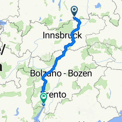
Kreuth - Innsbruck
A cycling route starting in Kreuth, Bavaria, Germany.
Overview
About this route
Leichter Anstieg zum Achenpass, dann Abfahrt ins Inntal entlang des Inn bis Innsbruck.
Uferradweg entlang des Achensee und Inntalradweg angenehm zufahren.
- -:--
- Duration
- 91.8 km
- Distance
- 454 m
- Ascent
- 670 m
- Descent
- ---
- Avg. speed
- ---
- Avg. speed
Route quality
Waytypes & surfaces along the route
Waytypes
Busy road
25.5 km
(28 %)
Quiet road
24.8 km
(27 %)
Surfaces
Paved
86.2 km
(94 %)
Unpaved
0.3 km
(<1 %)
Asphalt
83.4 km
(91 %)
Paved (undefined)
2.1 km
(2 %)
Continue with Bikemap
Use, edit, or download this cycling route
You would like to ride Kreuth - Innsbruck or customize it for your own trip? Here is what you can do with this Bikemap route:
Free features
- Save this route as favorite or in collections
- Copy & plan your own version of this route
- Sync your route with Garmin or Wahoo
Premium features
Free trial for 3 days, or one-time payment. More about Bikemap Premium.
- Navigate this route on iOS & Android
- Export a GPX / KML file of this route
- Create your custom printout (try it for free)
- Download this route for offline navigation
Discover more Premium features.
Get Bikemap PremiumFrom our community
Other popular routes starting in Kreuth
 Roehrloosalm_Lenggries
- Distance
- 9 km
- Ascent
- 115 m
- Descent
- 513 m
- Location
- Kreuth, Bavaria, Germany
 Große Runde Am Tegernsee über Erzherzog-Johann-Klause CLONED FROM ROUTE 213010
- Distance
- 43.8 km
- Ascent
- 773 m
- Descent
- 779 m
- Location
- Kreuth, Bavaria, Germany
 2014_1_Großglockner-Runde_Tegernsee/Kreuth - Scheffau a. Wilden Kaiser
- Distance
- 86.8 km
- Ascent
- 1,006 m
- Descent
- 1,133 m
- Location
- Kreuth, Bavaria, Germany
 Schinder Umrundung kurz
- Distance
- 45.6 km
- Ascent
- 1,352 m
- Descent
- 1,352 m
- Location
- Kreuth, Bavaria, Germany
 Transalp Tegernsee - Gardasee
- Distance
- 350.6 km
- Ascent
- 7,795 m
- Descent
- 8,502 m
- Location
- Kreuth, Bavaria, Germany
 Hirschberg - Hammer Trail
- Distance
- 20.8 km
- Ascent
- 704 m
- Descent
- 705 m
- Location
- Kreuth, Bavaria, Germany
 Gufferthütte bis Achenkirchen
- Distance
- 15.8 km
- Ascent
- 447 m
- Descent
- 986 m
- Location
- Kreuth, Bavaria, Germany
 Erzherzog-Johann-Reib'n
- Distance
- 44.6 km
- Ascent
- 838 m
- Descent
- 836 m
- Location
- Kreuth, Bavaria, Germany
Open it in the app