

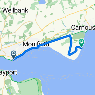
Monifieth and Sidlaw Ward, Dundee to 47–81 Beach Crescent, Broughty Ferry, Dundee
A cycling route starting in Tayport, Scotland, United Kingdom.
Overview
About this route
- 2 h 16 min
- Duration
- 26.2 km
- Distance
- 36 m
- Ascent
- 38 m
- Descent
- 11.6 km/h
- Avg. speed
- 13 m
- Avg. speed

Route quality
Waytypes & surfaces along the route
Waytypes
Cycleway
17.1 km
(65 %)
Quiet road
3.5 km
(13 %)
Surfaces
Paved
18.9 km
(72 %)
Asphalt
18.6 km
(71 %)
Paved (undefined)
0.2 km
(<1 %)
Continue with Bikemap
Use, edit, or download this cycling route
You would like to ride Monifieth and Sidlaw Ward, Dundee to 47–81 Beach Crescent, Broughty Ferry, Dundee or customize it for your own trip? Here is what you can do with this Bikemap route:
Free features
- Save this route as favorite or in collections
- Copy & plan your own version of this route
- Sync your route with Garmin or Wahoo
Premium features
Free trial for 3 days, or one-time payment. More about Bikemap Premium.
- Navigate this route on iOS & Android
- Export a GPX / KML file of this route
- Create your custom printout (try it for free)
- Download this route for offline navigation
Discover more Premium features.
Get Bikemap PremiumFrom our community
Other popular routes starting in Tayport
 gym and back
- Distance
- 14 km
- Ascent
- 147 m
- Descent
- 199 m
- Location
- Tayport, Scotland, United Kingdom
 Buddon Ness lighthouse
- Distance
- 13.1 km
- Ascent
- 9 m
- Descent
- 9 m
- Location
- Tayport, Scotland, United Kingdom
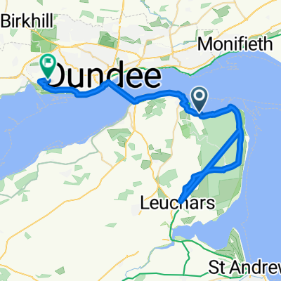
 Mill St, Broughty Ferry, Dundee to Mill St, Broughty Ferry, Dundee
- Distance
- 34.5 km
- Ascent
- 64 m
- Descent
- 62 m
- Location
- Tayport, Scotland, United Kingdom
 Tayport to Tentsmuir circular
- Distance
- 22.2 km
- Ascent
- 97 m
- Descent
- 91 m
- Location
- Tayport, Scotland, United Kingdom
 deeside tour from ferry
- Distance
- 225.8 km
- Ascent
- 1,412 m
- Descent
- 1,412 m
- Location
- Tayport, Scotland, United Kingdom
 Snail-like route in Dundee
- Distance
- 13 km
- Ascent
- 124 m
- Descent
- 104 m
- Location
- Tayport, Scotland, United Kingdom
 Unnamed Road to Lister Place
- Distance
- 39.5 km
- Ascent
- 180 m
- Descent
- 138 m
- Location
- Tayport, Scotland, United Kingdom
 High Street 48-50, Monifieth to Kinloch Street 62
- Distance
- 7 km
- Ascent
- 18 m
- Descent
- 20 m
- Location
- Tayport, Scotland, United Kingdom
Open it in the app