

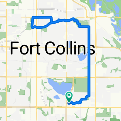
Recovered Route
A cycling route starting in Fort Collins, Colorado, United States of America.
Overview
About this route
- 2 h 1 min
- Duration
- 47.3 km
- Distance
- 170 m
- Ascent
- 211 m
- Descent
- 23.5 km/h
- Avg. speed
- 1,549 m
- Avg. speed
Route quality
Waytypes & surfaces along the route
Waytypes
Cycleway
18.4 km
(39 %)
Road
13 km
(28 %)
Surfaces
Paved
39 km
(82 %)
Asphalt
16.2 km
(34 %)
Concrete
14.9 km
(31 %)
Continue with Bikemap
Use, edit, or download this cycling route
You would like to ride Recovered Route or customize it for your own trip? Here is what you can do with this Bikemap route:
Free features
- Save this route as favorite or in collections
- Copy & plan your own version of this route
- Sync your route with Garmin or Wahoo
Premium features
Free trial for 3 days, or one-time payment. More about Bikemap Premium.
- Navigate this route on iOS & Android
- Export a GPX / KML file of this route
- Create your custom printout (try it for free)
- Download this route for offline navigation
Discover more Premium features.
Get Bikemap PremiumFrom our community
Other popular routes starting in Fort Collins
 Buckhorn Mountain Loop
- Distance
- 75.4 km
- Ascent
- 1,107 m
- Descent
- 1,107 m
- Location
- Fort Collins, Colorado, United States of America
 WFM-Spring Canyon-Mason
- Distance
- 21.5 km
- Ascent
- 96 m
- Descent
- 96 m
- Location
- Fort Collins, Colorado, United States of America
 Lengthy ride through Fort Collins
- Distance
- 51.2 km
- Ascent
- 356 m
- Descent
- 357 m
- Location
- Fort Collins, Colorado, United States of America
 brother ride
- Distance
- 18.7 km
- Ascent
- 40 m
- Descent
- 40 m
- Location
- Fort Collins, Colorado, United States of America
 Discover - Noosa - Discover
- Distance
- 26.8 km
- Ascent
- 98 m
- Descent
- 101 m
- Location
- Fort Collins, Colorado, United States of America
 Fort Collins Colorado to Loveland Colorado
- Distance
- 55.8 km
- Ascent
- 1,295 m
- Descent
- 1,175 m
- Location
- Fort Collins, Colorado, United States of America
 Lory Park
- Distance
- 36.3 km
- Ascent
- 443 m
- Descent
- 440 m
- Location
- Fort Collins, Colorado, United States of America
 Foco stroll
- Distance
- 30.9 km
- Ascent
- 91 m
- Descent
- 90 m
- Location
- Fort Collins, Colorado, United States of America
Open it in the app