

Mississauga (Celebration Square) Through Toronto Waterfront and and Back
A cycling route starting in Mississauga, Ontario, Canada.
Overview
About this route
OVERVIEW: A round-trip that is mostly on trails and bike lanes. Very few of the route is on actual road - that is, the Downtown Toronto part. Feels like a nice adventure. Although the Queensway part may be quite boring, it adds some variety! However, there will be a lot of riders like you on the Waterfront Trail, so don't fret.
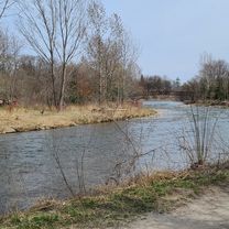
ROUTE DESCRIPTION: The route starts by skipping Port Credit and goes the edge of Mississauga next to the Etobicoke Creek. This is because that part is mostly in residential neighborhoods. Dixie's trails takes us to Marie Curtis Park (which is when we enter Etobicoke) then we connect to the Waterfront Trail. We'll take the Waterfront trail down to Downtown TO, going through places like St Lawrence Market, Eaton Centre, Nathan Philips and Yonge/Dundas Square, as well as around the entertainment district. Heading back, we will visit High Park and complete a loop around that park. Upon arriving to Mississauga, we'll finally take a glance at Port Credit's several parks, then after we'll take some trails and different roads back north to Celebration Square.
LENGTH: This route takes around 2 1/2 to 3 hours for more experienced cyclists, whereas 4 hours is more realistic.
I hope you enjoy this route! Feel free to visit anywhere you wish in Toronto. Feedback is appreciated!
- -:--
- Duration
- 83.7 km
- Distance
- 585 m
- Ascent
- 585 m
- Descent
- ---
- Avg. speed
- 165 m
- Avg. speed

Route quality
Waytypes & surfaces along the route
Waytypes
Cycleway
33.3 km
(40 %)
Quiet road
18.2 km
(22 %)
Surfaces
Paved
72.8 km
(87 %)
Unpaved
0.1 km
(<1 %)
Asphalt
69.1 km
(83 %)
Concrete
3.2 km
(4 %)
Continue with Bikemap
Use, edit, or download this cycling route
You would like to ride Mississauga (Celebration Square) Through Toronto Waterfront and and Back or customize it for your own trip? Here is what you can do with this Bikemap route:
Free features
- Save this route as favorite or in collections
- Copy & plan your own version of this route
- Sync your route with Garmin or Wahoo
Premium features
Free trial for 3 days, or one-time payment. More about Bikemap Premium.
- Navigate this route on iOS & Android
- Export a GPX / KML file of this route
- Create your custom printout (try it for free)
- Download this route for offline navigation
Discover more Premium features.
Get Bikemap PremiumFrom our community
Other popular routes starting in Mississauga
 30k around the block
- Distance
- 29.1 km
- Ascent
- 124 m
- Descent
- 127 m
- Location
- Mississauga, Ontario, Canada
 Etobicoke-Lakeshore-Miss Road
- Distance
- 40.5 km
- Ascent
- 133 m
- Descent
- 131 m
- Location
- Mississauga, Ontario, Canada
 Riverwood-SawmillValley-Culham Loop
- Distance
- 10.1 km
- Ascent
- 90 m
- Descent
- 93 m
- Location
- Mississauga, Ontario, Canada
 Erindale route...long
- Distance
- 29.6 km
- Ascent
- 296 m
- Descent
- 289 m
- Location
- Mississauga, Ontario, Canada
 MBRC-Campbellville via Hwy25 Speyside climb 52km
- Distance
- 52.1 km
- Ascent
- 235 m
- Descent
- 121 m
- Location
- Mississauga, Ontario, Canada
 bike tour through Mississauga Rd
- Distance
- 17.3 km
- Ascent
- 116 m
- Descent
- 116 m
- Location
- Mississauga, Ontario, Canada
 belfountain ride
- Distance
- 74 km
- Ascent
- 405 m
- Descent
- 405 m
- Location
- Mississauga, Ontario, Canada
 Violet Road 4449, Mississauga to Violet Road 4449, Mississauga
- Distance
- 11.9 km
- Ascent
- 83 m
- Descent
- 52 m
- Location
- Mississauga, Ontario, Canada
Open it in the app