

Linz-Ottensheim-Aschach-B.Schallerbach-Wels-Linz
A cycling route starting in Leonding, Upper Austria, Austria.
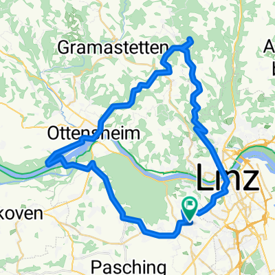
Overview
About this route
leider 2 kurze unbefestigte Abschnitte (Ausweichmöglichkeiten vorhanden)
Umfahrung der 1.: auf der Straße auf dem Schallerbacher Berg bleiben und nicht den Panaromaradweg nehmen (kurzer unbefestigter Weg)
Umfahrung der 2.:nach Zoo Schmiding gerade aus und nicht die Abzweigung "Panoramaradweg" (kurzes Stück auf unbefestigten Weg)nehmen
- -:--
- Duration
- 117.6 km
- Distance
- 174 m
- Ascent
- 175 m
- Descent
- ---
- Avg. speed
- ---
- Avg. speed
Route quality
Waytypes & surfaces along the route
Waytypes
Quiet road
54.1 km
(46 %)
Cycleway
15.9 km
(14 %)
Surfaces
Paved
78.1 km
(66 %)
Unpaved
1.4 km
(1 %)
Asphalt
74.5 km
(63 %)
Paved (undefined)
3.3 km
(3 %)
Continue with Bikemap
Use, edit, or download this cycling route
You would like to ride Linz-Ottensheim-Aschach-B.Schallerbach-Wels-Linz or customize it for your own trip? Here is what you can do with this Bikemap route:
Free features
- Save this route as favorite or in collections
- Copy & plan your own version of this route
- Sync your route with Garmin or Wahoo
Premium features
Free trial for 3 days, or one-time payment. More about Bikemap Premium.
- Navigate this route on iOS & Android
- Export a GPX / KML file of this route
- Create your custom printout (try it for free)
- Download this route for offline navigation
Discover more Premium features.
Get Bikemap PremiumFrom our community
Other popular routes starting in Leonding
 Rr21_20150911_141753.gpx
- Distance
- 50.5 km
- Ascent
- 209 m
- Descent
- 208 m
- Location
- Leonding, Upper Austria, Austria
 Leonding-Gis-Kirchschlag-Helmonsödt-Pelmberg-Leonding
- Distance
- 49.4 km
- Ascent
- 1,254 m
- Descent
- 1,286 m
- Location
- Leonding, Upper Austria, Austria
 Linz - Wallsee - Linz
- Distance
- 88.4 km
- Ascent
- 95 m
- Descent
- 95 m
- Location
- Leonding, Upper Austria, Austria
 Linz - Ottensheim - Lassersdorf - Waxenberg - Eidenberg -Lichtenberg
- Distance
- 82.5 km
- Ascent
- 1,040 m
- Descent
- 1,033 m
- Location
- Leonding, Upper Austria, Austria
 Leonding-Gis-Ottensheim-Leonding
- Distance
- 45.6 km
- Ascent
- 842 m
- Descent
- 835 m
- Location
- Leonding, Upper Austria, Austria
 Harald's Abendroute
- Distance
- 17.3 km
- Ascent
- 42 m
- Descent
- 43 m
- Location
- Leonding, Upper Austria, Austria
 Trail Friesenegg – Freinberg
- Distance
- 1.7 km
- Ascent
- 15 m
- Descent
- 58 m
- Location
- Leonding, Upper Austria, Austria
 Trail Kürnbergburg – Rufling
- Distance
- 1.8 km
- Ascent
- 25 m
- Descent
- 195 m
- Location
- Leonding, Upper Austria, Austria
Open it in the app