

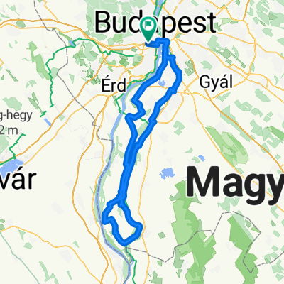
Bp - Velence - Bp (sin vuelta al lago)
A cycling route starting in Budapest XI. kerület, Budapest főváros, Hungary.
Overview
About this route
- 8 h 29 min
- Duration
- 120.6 km
- Distance
- 1,077 m
- Ascent
- 1,077 m
- Descent
- 14.2 km/h
- Avg. speed
- 258 m
- Avg. speed

Route quality
Waytypes & surfaces along the route
Waytypes
Quiet road
66.4 km
(55 %)
Cycleway
31.5 km
(26 %)
Surfaces
Paved
107.8 km
(89 %)
Unpaved
2.4 km
(2 %)
Asphalt
106.5 km
(88 %)
Unpaved (undefined)
1.3 km
(1 %)
Continue with Bikemap
Use, edit, or download this cycling route
You would like to ride Bp - Velence - Bp (sin vuelta al lago) or customize it for your own trip? Here is what you can do with this Bikemap route:
Free features
- Save this route as favorite or in collections
- Copy & plan your own version of this route
- Sync your route with Garmin or Wahoo
Premium features
Free trial for 3 days, or one-time payment. More about Bikemap Premium.
- Navigate this route on iOS & Android
- Export a GPX / KML file of this route
- Create your custom printout (try it for free)
- Download this route for offline navigation
Discover more Premium features.
Get Bikemap PremiumFrom our community
Other popular routes starting in Budapest XI. kerület
 buda fincsi emelkedői selection
- Distance
- 48.9 km
- Ascent
- 1,273 m
- Descent
- 920 m
- Location
- Budapest XI. kerület, Budapest főváros, Hungary
 Untitled route
- Distance
- 37.1 km
- Ascent
- 242 m
- Descent
- 236 m
- Location
- Budapest XI. kerület, Budapest főváros, Hungary
 Von Budapest bis Budaörs
- Distance
- 7.1 km
- Ascent
- 52 m
- Descent
- 84 m
- Location
- Budapest XI. kerület, Budapest főváros, Hungary
 Csepel sziget túra a Magyar Kerékpárosklubbal
- Distance
- 129.1 km
- Ascent
- 32 m
- Descent
- 31 m
- Location
- Budapest XI. kerület, Budapest főváros, Hungary
 normafabudaörs ünnepi
- Distance
- 32.6 km
- Ascent
- 511 m
- Descent
- 512 m
- Location
- Budapest XI. kerület, Budapest főváros, Hungary
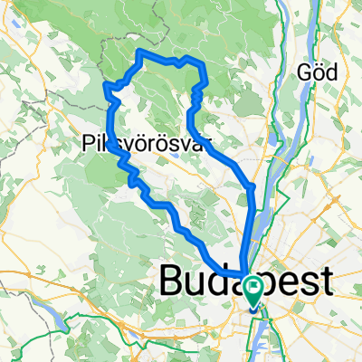 csillaghegy-rókahegy-csobánka-lajosforrás-fagyoskatona-pilisszentkereszt-piros-nagykovácsi-hűvösvölgy
- Distance
- 81.1 km
- Ascent
- 1,159 m
- Descent
- 1,160 m
- Location
- Budapest XI. kerület, Budapest főváros, Hungary
 Kopaszigát - Érd - Diósd - Törökbálint - Kopaszigát
- Distance
- 48.2 km
- Ascent
- 257 m
- Descent
- 261 m
- Location
- Budapest XI. kerület, Budapest főváros, Hungary
 Gazdagrét - Peron Büfé
- Distance
- 17.6 km
- Ascent
- 137 m
- Descent
- 99 m
- Location
- Budapest XI. kerület, Budapest főváros, Hungary
Open it in the app