
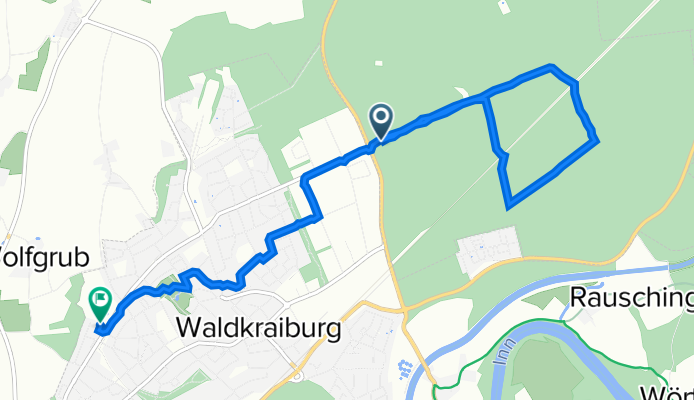
Maxlinie, Mühldorfer Hart - Von-der-Tann-Straße 6, Waldkraiburg
A cycling route starting in Waldkraiburg, Bavaria, Germany.
Overview
About this route
- 38 min
- Duration
- 8.9 km
- Distance
- 103 m
- Ascent
- 101 m
- Descent
- 14.2 km/h
- Avg. speed
- 477 m
- Avg. speed

Route quality
Waytypes & surfaces along the route
Waytypes
Track
4.2 km
(47 %)
Quiet road
1.5 km
(17 %)
Surfaces
Paved
2.2 km
(25 %)
Unpaved
5.3 km
(59 %)
Gravel
5.2 km
(59 %)
Asphalt
1.8 km
(20 %)
Continue with Bikemap
Use, edit, or download this cycling route
You would like to ride Maxlinie, Mühldorfer Hart - Von-der-Tann-Straße 6, Waldkraiburg or customize it for your own trip? Here is what you can do with this Bikemap route:
Free features
- Save this route as favorite or in collections
- Copy & plan your own version of this route
- Sync your route with Garmin or Wahoo
Premium features
Free trial for 3 days, or one-time payment. More about Bikemap Premium.
- Navigate this route on iOS & Android
- Export a GPX / KML file of this route
- Create your custom printout (try it for free)
- Download this route for offline navigation
Discover more Premium features.
Get Bikemap PremiumFrom our community
Other popular routes starting in Waldkraiburg
 Interesante Route
- Distance
- 60.1 km
- Ascent
- 550 m
- Descent
- 502 m
- Location
- Waldkraiburg, Bavaria, Germany
 Wkb Frauendorf Taufkirchen Hundberg Lafering Wkb Süd 03
- Distance
- 28.3 km
- Ascent
- 250 m
- Descent
- 242 m
- Location
- Waldkraiburg, Bavaria, Germany
 Thementour_Feierabend_Runde
- Distance
- 35.1 km
- Ascent
- 164 m
- Descent
- 163 m
- Location
- Waldkraiburg, Bavaria, Germany
 Oberornau Stierberg Nord 01
- Distance
- 46.6 km
- Ascent
- 446 m
- Descent
- 444 m
- Location
- Waldkraiburg, Bavaria, Germany
 Wintertraining
- Distance
- 42.1 km
- Ascent
- 155 m
- Descent
- 156 m
- Location
- Waldkraiburg, Bavaria, Germany
 Reichenberger Straße 24A nach Heisererplatz
- Distance
- 29.3 km
- Ascent
- 350 m
- Descent
- 357 m
- Location
- Waldkraiburg, Bavaria, Germany
 MTB Runde
- Distance
- 53 km
- Ascent
- 591 m
- Descent
- 523 m
- Location
- Waldkraiburg, Bavaria, Germany
 Herbstrunde
- Distance
- 37.5 km
- Ascent
- 291 m
- Descent
- 278 m
- Location
- Waldkraiburg, Bavaria, Germany
Open it in the app