

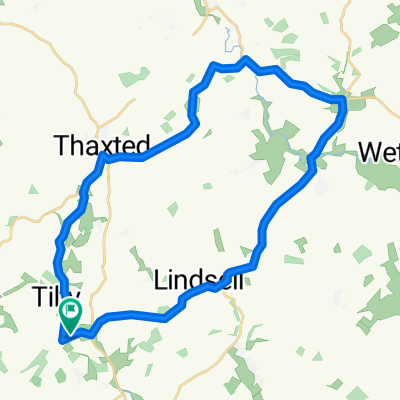
11–39 The Street, High Easter, Chelmsford to 1 Lordship Cottages, Lordship Road, Chelmsford
A cycling route starting in Great Dunmow, England, United Kingdom.
Overview
About this route
- 37 min
- Duration
- 24.2 km
- Distance
- 188 m
- Ascent
- 234 m
- Descent
- 39.7 km/h
- Avg. speed
- 90 m
- Avg. speed

Route quality
Waytypes & surfaces along the route
Waytypes
Road
23.1 km
(95 %)
Cycleway
0.6 km
(2 %)
Surfaces
Paved
23.2 km
(96 %)
Asphalt
22.9 km
(95 %)
Paved (undefined)
0.2 km
(<1 %)
Undefined
1.1 km
(4 %)
Continue with Bikemap
Use, edit, or download this cycling route
You would like to ride 11–39 The Street, High Easter, Chelmsford to 1 Lordship Cottages, Lordship Road, Chelmsford or customize it for your own trip? Here is what you can do with this Bikemap route:
Free features
- Save this route as favorite or in collections
- Copy & plan your own version of this route
- Sync your route with Garmin or Wahoo
Premium features
Free trial for 3 days, or one-time payment. More about Bikemap Premium.
- Navigate this route on iOS & Android
- Export a GPX / KML file of this route
- Create your custom printout (try it for free)
- Download this route for offline navigation
Discover more Premium features.
Get Bikemap PremiumFrom our community
Other popular routes starting in Great Dunmow
 Steady ride in Dunmow
- Distance
- 2.7 km
- Ascent
- 36 m
- Descent
- 27 m
- Location
- Great Dunmow, England, United Kingdom
 Pleshey 25km
- Distance
- 25.4 km
- Ascent
- 116 m
- Descent
- 123 m
- Location
- Great Dunmow, England, United Kingdom
 White Barns 6, Ford End to White Barns 6, Ford End
- Distance
- 23.2 km
- Ascent
- 148 m
- Descent
- 143 m
- Location
- Great Dunmow, England, United Kingdom
 DunmowCamb
- Distance
- 53.5 km
- Ascent
- 172 m
- Descent
- 213 m
- Location
- Great Dunmow, England, United Kingdom
 Easton_Camb_45k
- Distance
- 45.2 km
- Ascent
- 227 m
- Descent
- 247 m
- Location
- Great Dunmow, England, United Kingdom
 AC_Easton_30k
- Distance
- 29.3 km
- Ascent
- 173 m
- Descent
- 173 m
- Location
- Great Dunmow, England, United Kingdom
 26 mile
- Distance
- 42.1 km
- Ascent
- 213 m
- Descent
- 212 m
- Location
- Great Dunmow, England, United Kingdom
 FG > Rayne and back via Flitch Way
- Distance
- 16.1 km
- Ascent
- 66 m
- Descent
- 66 m
- Location
- Great Dunmow, England, United Kingdom
Open it in the app