

Mississauga to Burlington (Hamilton)
A cycling route starting in Mississauga, Ontario, Canada.
Overview
About this route
OVERVIEW: A round-trip that is entirely on trails and bike lanes, so there's no danger. The furthest we'll go is on the Burlington Skyway, just poking through Hamilton.
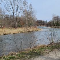
ROUTE DESCRIPTION: The route starts at Mississauga's Celebration Square by skipping Port Credit and goes to Erin Mills Pkwy via the Burnhamthorpe Trail. This road is taken down all the way to Lakeshore Rd (Watefront Trail). On your way to your destination, you'll pass through places like Lakeside Park, Tannery Park, Downtown Oakville, Coronation Park, Bronte's Parks, Downtown Burlington, Burloak Waterfront Park, Paletta Lakefront Park, Sioux Lookout Park, Spencer Smith Park, and finally, the Burlington Skyway where you can see the Toronto skyline. Afterwards, we will head back using the same route (or you can choose to not use the waterfront trail, which would decrease milage but increase time). Heading back is the same, however we will be able to visit Jack Darling Memorial Park, Brueckner Rhododendron Gardens, J.C. Saddington Park, Port Credit, JJ Plaus Park, and St Lawrence Park. A great place to relax after heading back to celebration square is Port Credit. Once we head out of the waterfront, we'll take Hurontario up to the Cooksville Creek Trail for a nice slow scenic ending to a long 100km journey.
LENGTH: This trip takes around 3 1/2 to 4 hours for more experienced cyclists, whereas 4 1/2 to 5 1/2 hours is more realistic. With stops to take pictures or visit parks, eating, relaxing, it may take 8 hours. I would leave at 8 AM and you'll be back at 4-5 PM AT MOST.
I hope you enjoy this route! Feel free to customize the second half of the trip, if you find heading back on the same trail is boring. Feedback is appreciated!
- -:--
- Duration
- 100 km
- Distance
- 595 m
- Ascent
- 595 m
- Descent
- ---
- Avg. speed
- 160 m
- Avg. speed

Route quality
Waytypes & surfaces along the route
Waytypes
Busy road
35.8 km
(36 %)
Cycleway
34.3 km
(34 %)
Surfaces
Paved
68.6 km
(69 %)
Unpaved
1.3 km
(1 %)
Asphalt
67 km
(67 %)
Concrete
1.6 km
(2 %)
Continue with Bikemap
Use, edit, or download this cycling route
You would like to ride Mississauga to Burlington (Hamilton) or customize it for your own trip? Here is what you can do with this Bikemap route:
Free features
- Save this route as favorite or in collections
- Copy & plan your own version of this route
- Sync your route with Garmin or Wahoo
Premium features
Free trial for 3 days, or one-time payment. More about Bikemap Premium.
- Navigate this route on iOS & Android
- Export a GPX / KML file of this route
- Create your custom printout (try it for free)
- Download this route for offline navigation
Discover more Premium features.
Get Bikemap PremiumFrom our community
Other popular routes starting in Mississauga
 Violet Road 4449, Mississauga to Violet Road 4449, Mississauga
- Distance
- 11.9 km
- Ascent
- 83 m
- Descent
- 52 m
- Location
- Mississauga, Ontario, Canada
 Etobicoke-Lakeshore-Miss Road
- Distance
- 40.5 km
- Ascent
- 133 m
- Descent
- 131 m
- Location
- Mississauga, Ontario, Canada
 bike tour through Mississauga Rd
- Distance
- 17.3 km
- Ascent
- 116 m
- Descent
- 116 m
- Location
- Mississauga, Ontario, Canada
 Day2_Missiisauga to Niagara Falls
- Distance
- 119.8 km
- Ascent
- 385 m
- Descent
- 354 m
- Location
- Mississauga, Ontario, Canada
 MBRC-Campbellville via Hwy25 Speyside climb 52km
- Distance
- 52.1 km
- Ascent
- 235 m
- Descent
- 121 m
- Location
- Mississauga, Ontario, Canada
 Riverwood-SawmillValley-Culham Loop
- Distance
- 10.1 km
- Ascent
- 90 m
- Descent
- 93 m
- Location
- Mississauga, Ontario, Canada
 2689 Hollington Cres, Mississauga to 2652 Hollington Cres, Mississauga
- Distance
- 16.2 km
- Ascent
- 162 m
- Descent
- 161 m
- Location
- Mississauga, Ontario, Canada
 Erindale route...long
- Distance
- 29.6 km
- Ascent
- 296 m
- Descent
- 289 m
- Location
- Mississauga, Ontario, Canada
Open it in the app