

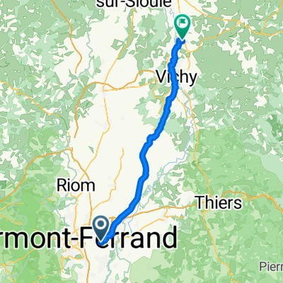
25 Rue du 19 Mars 1962, Lempdes à 25 Rue du 19 Mars 1962, Lempdes
A cycling route starting in Aulnat, Auvergne-Rhône-Alpes, France.
Overview
About this route
- 2 h 17 min
- Duration
- 29.9 km
- Distance
- 316 m
- Ascent
- 315 m
- Descent
- 13.2 km/h
- Avg. speed
- 442 m
- Max. altitude
Route quality
Waytypes & surfaces along the route
Waytypes
Cycleway
9 km
(30 %)
Quiet road
7.5 km
(25 %)
Surfaces
Paved
18.9 km
(63 %)
Unpaved
2.4 km
(8 %)
Asphalt
17.4 km
(58 %)
Concrete
1.5 km
(5 %)
Continue with Bikemap
Use, edit, or download this cycling route
You would like to ride 25 Rue du 19 Mars 1962, Lempdes à 25 Rue du 19 Mars 1962, Lempdes or customize it for your own trip? Here is what you can do with this Bikemap route:
Free features
- Save this route as favorite or in collections
- Copy & plan your own version of this route
- Sync your route with Garmin or Wahoo
Premium features
Free trial for 3 days, or one-time payment. More about Bikemap Premium.
- Navigate this route on iOS & Android
- Export a GPX / KML file of this route
- Create your custom printout (try it for free)
- Download this route for offline navigation
Discover more Premium features.
Get Bikemap PremiumFrom our community
Other popular routes starting in Aulnat
 Itinéraire facile en Lempdes
- Distance
- 14 km
- Ascent
- 198 m
- Descent
- 200 m
- Location
- Aulnat, Auvergne-Rhône-Alpes, France
 maison
- Distance
- 60.1 km
- Ascent
- 401 m
- Descent
- 343 m
- Location
- Aulnat, Auvergne-Rhône-Alpes, France
 25 Rue du 19 Mars 1962, Lempdes à 25 Rue du 19 Mars 1962, Lempdes
- Distance
- 29.9 km
- Ascent
- 316 m
- Descent
- 315 m
- Location
- Aulnat, Auvergne-Rhône-Alpes, France
 25 Rue du 19 Mars 1962, Lempdes à 25 Rue du 19 Mars 1962, Lempdes
- Distance
- 30.4 km
- Ascent
- 356 m
- Descent
- 355 m
- Location
- Aulnat, Auvergne-Rhône-Alpes, France
 Avenue de l'Europe, Lempdes à Rue Valéry Larbaud, Saint-Germain-des-Fossés
- Distance
- 64.1 km
- Ascent
- 332 m
- Descent
- 392 m
- Location
- Aulnat, Auvergne-Rhône-Alpes, France
 Dominique
- Distance
- 2.9 km
- Ascent
- 11 m
- Descent
- 6 m
- Location
- Aulnat, Auvergne-Rhône-Alpes, France
 Clermont - Beziers Le Cevenol
- Distance
- 428.6 km
- Ascent
- 2,256 m
- Descent
- 2,570 m
- Location
- Aulnat, Auvergne-Rhône-Alpes, France
 Rondje door Auvergne v1
- Distance
- 439.9 km
- Ascent
- 4,094 m
- Descent
- 4,097 m
- Location
- Aulnat, Auvergne-Rhône-Alpes, France
Open it in the app