

2023-05-28 Ruta: 48 bis
A cycling route starting in Valladolid, Castille and León, Spain.
Overview
About this route
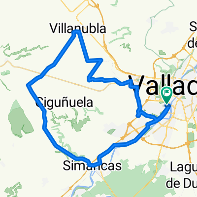
Pte.Mayor - Zaratán - Wamba- Peñaflor - Torrelobaton - Velilla - (Matilla avituallamiento) - Pedroso - Villan - Robladillo - Ciguñuela - Zaratán - Valladolid.
1ª Subida: Teso de AirePend media 4,9% - Distancia 2,1 km
Repecho Ventolera(No puntua)
2ª Subida: Páramo: El VentorroPend media 3,7% - Distancia 4,3 km
3ª Subida: El ParamilloPend media 3,2% - Distancia 3,5 km
Repecho: Alto: Ciguñuela No puntua)
- -:--
- Duration
- 84 km
- Distance
- 703 m
- Ascent
- 702 m
- Descent
- ---
- Avg. speed
- 846 m
- Avg. speed

Route quality
Waytypes & surfaces along the route
Waytypes
Road
37.9 km
(45 %)
Busy road
19.3 km
(23 %)
Surfaces
Paved
69.2 km
(82 %)
Unpaved
4.6 km
(5 %)
Asphalt
68 km
(81 %)
Ground
2.5 km
(3 %)
Route highlights
Points of interest along the route
Point of interest after 10 km
1ª Subida: Teso de Aire Pend media 4,9% Distancia 2,1 km
Point of interest after 23.1 km
Repecho: Ventolera (no puntua)
Point of interest after 39.6 km
2ª Subida: Paramo : El Ventorro Pend media 3,7% - Distancia 4,2 km
Point of interest after 65.2 km
3ª Subida:Alto. El Paramillo Pend media 3,2% - Distancia 3,5 km
Point of interest after 69.8 km
Repecho: Alto: Ciguñuela No puntua)
Continue with Bikemap
Use, edit, or download this cycling route
You would like to ride 2023-05-28 Ruta: 48 bis or customize it for your own trip? Here is what you can do with this Bikemap route:
Free features
- Save this route as favorite or in collections
- Copy & plan your own version of this route
- Sync your route with Garmin or Wahoo
Premium features
Free trial for 3 days, or one-time payment. More about Bikemap Premium.
- Navigate this route on iOS & Android
- Export a GPX / KML file of this route
- Create your custom printout (try it for free)
- Download this route for offline navigation
Discover more Premium features.
Get Bikemap PremiumFrom our community
Other popular routes starting in Valladolid
 Ciguñuela
- Distance
- 16.3 km
- Ascent
- 200 m
- Descent
- 103 m
- Location
- Valladolid, Castille and León, Spain
 Zaratán - Villanubla - Simancas
- Distance
- 44.5 km
- Ascent
- 254 m
- Descent
- 255 m
- Location
- Valladolid, Castille and León, Spain
 2022 - Ruta nº 062
- Distance
- 118.5 km
- Ascent
- 683 m
- Descent
- 686 m
- Location
- Valladolid, Castille and León, Spain
 2022 - Ruta nº 073
- Distance
- 98.2 km
- Ascent
- 439 m
- Descent
- 442 m
- Location
- Valladolid, Castille and León, Spain
 vueltecilla mtb
- Distance
- 21.9 km
- Ascent
- 168 m
- Descent
- 159 m
- Location
- Valladolid, Castille and León, Spain
 2022 - Ruta nº 063
- Distance
- 100.1 km
- Ascent
- 201 m
- Descent
- 199 m
- Location
- Valladolid, Castille and León, Spain
 2022 - Ruta nº 059
- Distance
- 130.1 km
- Ascent
- 733 m
- Descent
- 733 m
- Location
- Valladolid, Castille and León, Spain
 Ruta: 20-Mayo-2018 - (PM - Amistad)
- Distance
- 92.8 km
- Ascent
- 435 m
- Descent
- 431 m
- Location
- Valladolid, Castille and León, Spain
Open it in the app