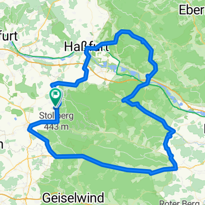
von Geusfeld zum Schlangenweg und zurück
A cycling route starting in Michelau, Bavaria, Germany.
Overview
About this route
<span class="Apple-style-span" style="color: #441155; font-family: Verdana,Arial,sans-serif; font-size: 10px; font-style: normal; font-variant: normal; font-weight: 300; letter-spacing: normal; line-height: 13px; orphans: 2; text-align: justify; text-indent: 0px; text-transform: none; white-space: normal; widows: 2; word-spacing: 0px; background-color: #ffffff;">Der "Schlangenweg" ist eine der schönsten Trails im Steigerwald die ich kenne. Wer ihn genießen möchte fährt den Schlangenweg von oben nach unten, wer den Schlangenweg bezwingen will fährt anders herum. Diesen Schlangenweg habe ich in dieser Tour eingebunden. Hier beschreibe ich die Route für die Genießertour. Auch wenn es sich harmlos anhört, sie ist nichts für Anfänger. Höhenangst und die Angst vor schmutzigen Schuhen (und Hosen und Fahrrad und...) ist (sind) hier fehl am Platz. Der Schlangenweg läuft auf halber Höhe dem Hang entlang, nennenswerte Steigungen gibt es nicht. Eine gute Balance und Ausdauer genügen für diese Tour. Wer den Schlangenweg nicht mit dem Rad bezwingen möchte oder kann, für dem ist eine Wanderung eine nicht zu verachtende Alternative.</span>
66ger-jahrgang.de
- -:--
- Duration
- 35 km
- Distance
- 557 m
- Ascent
- 546 m
- Descent
- ---
- Avg. speed
- ---
- Avg. speed
Continue with Bikemap
Use, edit, or download this cycling route
You would like to ride von Geusfeld zum Schlangenweg und zurück or customize it for your own trip? Here is what you can do with this Bikemap route:
Free features
- Save this route as favorite or in collections
- Copy & plan your own version of this route
- Sync your route with Garmin or Wahoo
Premium features
Free trial for 3 days, or one-time payment. More about Bikemap Premium.
- Navigate this route on iOS & Android
- Export a GPX / KML file of this route
- Create your custom printout (try it for free)
- Download this route for offline navigation
Discover more Premium features.
Get Bikemap PremiumFrom our community
Other popular routes starting in Michelau
 Hundelshausen, Ebrach und Zurück
- Distance
- 29.3 km
- Ascent
- 454 m
- Descent
- 454 m
- Location
- Michelau, Bavaria, Germany
 Haßfurt - Gerolzhofen - Ebrach - Ebelsbach und zurück
- Distance
- 114.9 km
- Ascent
- 748 m
- Descent
- 763 m
- Location
- Michelau, Bavaria, Germany
 Bikepacking Steigerwald 2
- Distance
- 109 km
- Ascent
- 1,176 m
- Descent
- 976 m
- Location
- Michelau, Bavaria, Germany
 Ausfahrt zum Zabelstein
- Distance
- 12.8 km
- Ascent
- 304 m
- Descent
- 293 m
- Location
- Michelau, Bavaria, Germany
 D_Bayern_Neuhausen-Heinachshof-Zabelstein-Falkenstein-Geusfelderweg-(MichelauImSteigerwald)_RR-18km-400hm
- Distance
- 18.1 km
- Ascent
- 406 m
- Descent
- 396 m
- Location
- Michelau, Bavaria, Germany
 Geusfeld- Schlangenweg- Neuhaus- Zabelstein
- Distance
- 36.5 km
- Ascent
- 495 m
- Descent
- 494 m
- Location
- Michelau, Bavaria, Germany
 von Geusfeld zum Schlangenweg und zurück
- Distance
- 35 km
- Ascent
- 557 m
- Descent
- 546 m
- Location
- Michelau, Bavaria, Germany
 U'steinbach-Heinachshof-Weilersbachtal
- Distance
- 26.3 km
- Ascent
- 316 m
- Descent
- 318 m
- Location
- Michelau, Bavaria, Germany
Open it in the app

