

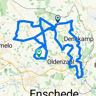
Fietsroute rond Lutterzand
A cycling route starting in Ootmarsum, Overijssel, The Netherlands.
Overview
About this route
The Lutterzand was formed in the late Middle Ages. Due to overgrazing and the cutting of heath turfs, bare spots appeared in the vegetation. The wind had free rein, causing sand drifts. To counter this, Scots pines were planted. The oldest and lowest sand layers on the banks of the Dinkel are up to twenty centuries old. Previous heath fires can be identified in the dark layers. The Meuleman estate, covering 340 hectares, constitutes the largest part of the nature reserve. The estate, owned by the Twente textile family Scholten, is largely open to the public. Balance on the Dutch-German border with even a small excursion into Germany. In this hilly area, you are guaranteed breathtaking views over the landscape.
- 2 h 32 min
- Duration
- 37.1 km
- Distance
- 0 m
- Ascent
- 0 m
- Descent
- 14.7 km/h
- Avg. speed
- 0 m
- Max. altitude
Route quality
Waytypes & surfaces along the route
Waytypes
Quiet road
18.6 km
(50 %)
Cycleway
14.9 km
(40 %)
Surfaces
Paved
23.4 km
(63 %)
Unpaved
9.3 km
(25 %)
Asphalt
20.1 km
(54 %)
Loose gravel
8.5 km
(23 %)
Continue with Bikemap
Use, edit, or download this cycling route
You would like to ride Fietsroute rond Lutterzand or customize it for your own trip? Here is what you can do with this Bikemap route:
Free features
- Save this route as favorite or in collections
- Copy & plan your own version of this route
- Sync your route with Garmin or Wahoo
Premium features
Free trial for 3 days, or one-time payment. More about Bikemap Premium.
- Navigate this route on iOS & Android
- Export a GPX / KML file of this route
- Create your custom printout (try it for free)
- Download this route for offline navigation
Discover more Premium features.
Get Bikemap PremiumFrom our community
Other popular routes starting in Ootmarsum
 Ootmarsum nach Delden
- Distance
- 36.9 km
- Ascent
- 52 m
- Descent
- 73 m
- Location
- Ootmarsum, Overijssel, The Netherlands
 Denekamp
- Distance
- 37.6 km
- Ascent
- 31 m
- Descent
- 34 m
- Location
- Ootmarsum, Overijssel, The Netherlands
 Back to the Roots Roads (zaterdag versie 1) (Track)
- Distance
- 137.7 km
- Ascent
- 0 m
- Descent
- 0 m
- Location
- Ootmarsum, Overijssel, The Netherlands
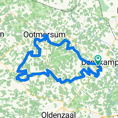 Fietsroute Landgoederen - Ootmarsum
- Distance
- 44.6 km
- Ascent
- 0 m
- Descent
- 0 m
- Location
- Ootmarsum, Overijssel, The Netherlands
 Ootmarsum_Rondje_north
- Distance
- 17.3 km
- Ascent
- 101 m
- Descent
- 107 m
- Location
- Ootmarsum, Overijssel, The Netherlands
 Ootmarsum
- Distance
- 13.3 km
- Ascent
- 82 m
- Descent
- 83 m
- Location
- Ootmarsum, Overijssel, The Netherlands
 Aufnahme vom 2. August, 12:00
- Distance
- 34.5 km
- Ascent
- 71 m
- Descent
- 69 m
- Location
- Ootmarsum, Overijssel, The Netherlands
 Fietsroute rond Lutterzand
- Distance
- 37.1 km
- Ascent
- 0 m
- Descent
- 0 m
- Location
- Ootmarsum, Overijssel, The Netherlands
Open it in the app