

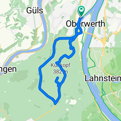
Mühlental-Denzerheide-Bad Ems-Lahn-Deutsches Eck 43km
A cycling route starting in Koblenz, Rhineland-Palatinate, Germany.
Overview
About this route
Auto parken in 56070 Lützel/Wasser+Schifffahrtsamt Schartwiesenstr. 4, Start, Balduinbrücke, Moselufer, Deutsches Eck, Rheinufer, Pfaffendorfer Brücke, Ehrenbreitstein, Mühlental, Weinhaus Wagner, Sauers Mühle, Korns Mühle, Forsthaus Elisenhof, Mühlenbacher Hof, B49 unterqueren, Panzerstraße, Höhrberg 344m, Golfplatz Denzerheide, Rabenkopf 371m, auf B261 Abfahrt nach Bad Ems, Lahnradweg, Fachbach Oberau, Ahler Schleuse, La Taverna, Schleuse Friedland, Schleusenhäuschen, Lahnstein, Wirtshaus an der Lahn, Maximilians Brauwiesen, Horchheim, über Eisenbahnbrücke aufs Oberwerth, Rheinuferradweg zum Deutschen Eck und zurück über Balduinbrücke nach Lützel
- -:--
- Duration
- 39 km
- Distance
- 571 m
- Ascent
- 566 m
- Descent
- ---
- Avg. speed
- 370 m
- Avg. speed
Route quality
Waytypes & surfaces along the route
Waytypes
Path
10.1 km
(26 %)
Quiet road
8.2 km
(21 %)
Surfaces
Paved
34.8 km
(89 %)
Unpaved
1.3 km
(3 %)
Asphalt
30.4 km
(78 %)
Paving stones
2.7 km
(7 %)
Continue with Bikemap
Use, edit, or download this cycling route
You would like to ride Mühlental-Denzerheide-Bad Ems-Lahn-Deutsches Eck 43km or customize it for your own trip? Here is what you can do with this Bikemap route:
Free features
- Save this route as favorite or in collections
- Copy & plan your own version of this route
- Sync your route with Garmin or Wahoo
Premium features
Free trial for 3 days, or one-time payment. More about Bikemap Premium.
- Navigate this route on iOS & Android
- Export a GPX / KML file of this route
- Create your custom printout (try it for free)
- Download this route for offline navigation
Discover more Premium features.
Get Bikemap PremiumFrom our community
Other popular routes starting in Koblenz
 Koblenz - Cochem
- Distance
- 50.6 km
- Ascent
- 222 m
- Descent
- 209 m
- Location
- Koblenz, Rhineland-Palatinate, Germany
 Koblenz-Trier
- Distance
- 199.6 km
- Ascent
- 1,926 m
- Descent
- 1,863 m
- Location
- Koblenz, Rhineland-Palatinate, Germany
 Eisenarsch-Tour 2009 (Vorschlag)
- Distance
- 174.5 km
- Ascent
- 424 m
- Descent
- 353 m
- Location
- Koblenz, Rhineland-Palatinate, Germany
 2025 6 Koblenz Wiesbaden
- Distance
- 91 km
- Ascent
- 814 m
- Descent
- 803 m
- Location
- Koblenz, Rhineland-Palatinate, Germany
 Mosel Thionville Mosel
- Distance
- 267 km
- Ascent
- 1,060 m
- Descent
- 989 m
- Location
- Koblenz, Rhineland-Palatinate, Germany
 KO-Fleckertshöhe-Alken-KO
- Distance
- 77.8 km
- Ascent
- 569 m
- Descent
- 568 m
- Location
- Koblenz, Rhineland-Palatinate, Germany
 RTF "Moselkarussel" 113km
- Distance
- 113.9 km
- Ascent
- 1,208 m
- Descent
- 1,168 m
- Location
- Koblenz, Rhineland-Palatinate, Germany
 Winter
- Distance
- 15.5 km
- Ascent
- 360 m
- Descent
- 360 m
- Location
- Koblenz, Rhineland-Palatinate, Germany