

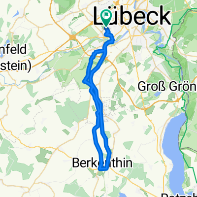
Elbe-Lübeck-Kanal
A cycling route starting in Lübeck, Schleswig-Holstein, Germany.
Overview
About this route
Willy-Brandt-Allee 7, 23554 Lübeck
Mölln:
Ristorante N°2 Am Seegarten: Dienstag-Sonntag: 12-15 Uhr Ruhetag: Montag
China-Restaurant: 12-15 Uhr kein Ruhetag
Quellenhof: 11:30-14 Uhr kein Ruhetag: Mittwoch
- 4 h 51 min
- Duration
- 76.6 km
- Distance
- 481 m
- Ascent
- 478 m
- Descent
- 15.8 km/h
- Avg. speed
- 76 m
- Avg. speed

Route quality
Waytypes & surfaces along the route
Waytypes
Cycleway
39.5 km
(52 %)
Quiet road
11.7 km
(15 %)
Surfaces
Paved
28.9 km
(38 %)
Unpaved
45.3 km
(59 %)
Loose gravel
27.9 km
(36 %)
Asphalt
25.5 km
(33 %)
Route highlights
Points of interest along the route
Accommodation after 30.9 km
China-Restaurant
Accommodation after 31.6 km
Ristorante N°2 Am Seegarten
Accommodation after 31.7 km
Quellenhof Mölln
Continue with Bikemap
Use, edit, or download this cycling route
You would like to ride Elbe-Lübeck-Kanal or customize it for your own trip? Here is what you can do with this Bikemap route:
Free features
- Save this route as favorite or in collections
- Copy & plan your own version of this route
- Sync your route with Garmin or Wahoo
Premium features
Free trial for 3 days, or one-time payment. More about Bikemap Premium.
- Navigate this route on iOS & Android
- Export a GPX / KML file of this route
- Create your custom printout (try it for free)
- Download this route for offline navigation
Discover more Premium features.
Get Bikemap PremiumFrom our community
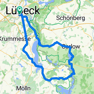
Other popular routes starting in Lübeck
 Vorrade-Barnitz-Stubben-Sandesneben-Krummesse-HL
- Distance
- 76.5 km
- Ascent
- 171 m
- Descent
- 169 m
- Location
- Lübeck, Schleswig-Holstein, Germany
 Elbe-Lübeck-Kanal 1
- Distance
- 17.6 km
- Ascent
- 56 m
- Descent
- 56 m
- Location
- Lübeck, Schleswig-Holstein, Germany
 St. Lorenz Nord nach Travemünde by Sven und Cata
- Distance
- 44.8 km
- Ascent
- 272 m
- Descent
- 268 m
- Location
- Lübeck, Schleswig-Holstein, Germany
 Grosse Feierabendrunde
- Distance
- 40.8 km
- Ascent
- 81 m
- Descent
- 77 m
- Location
- Lübeck, Schleswig-Holstein, Germany
 Die Steilküste entlang nach Boltenhagen
- Distance
- 100.7 km
- Ascent
- 297 m
- Descent
- 294 m
- Location
- Lübeck, Schleswig-Holstein, Germany
 Dag 1 söndag 1.7.18
- Distance
- 159.2 km
- Ascent
- 326 m
- Descent
- 282 m
- Location
- Lübeck, Schleswig-Holstein, Germany
 Feiertagsrunde mit Bennet
- Distance
- 35.5 km
- Ascent
- 87 m
- Descent
- 87 m
- Location
- Lübeck, Schleswig-Holstein, Germany
 Utecht-Rieps-Dutzow-Salem-RZ-Disnack
- Distance
- 79.9 km
- Ascent
- 288 m
- Descent
- 286 m
- Location
- Lübeck, Schleswig-Holstein, Germany
Open it in the app