

Recovered Route
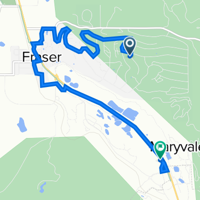
A cycling route starting in Fraser, Colorado, United States of America.
Overview
About this route
- 40 min
- Duration
- 8.4 km
- Distance
- 121 m
- Ascent
- 156 m
- Descent
- 12.5 km/h
- Avg. speed
- 2,689 m
- Avg. speed

Route quality
Waytypes & surfaces along the route
Waytypes
Quiet road
5.4 km
(64 %)
Cycleway
1.5 km
(18 %)
Surfaces
Paved
5 km
(60 %)
Unpaved
2.3 km
(28 %)
Asphalt
5 km
(60 %)
Unpaved (undefined)
2.3 km
(28 %)
Undefined
1 km
(12 %)
Continue with Bikemap
Use, edit, or download this cycling route
You would like to ride Recovered Route or customize it for your own trip? Here is what you can do with this Bikemap route:
Free features
- Save this route as favorite or in collections
- Copy & plan your own version of this route
- Sync your route with Garmin or Wahoo
Premium features
Free trial for 3 days, or one-time payment. More about Bikemap Premium.
- Navigate this route on iOS & Android
- Export a GPX / KML file of this route
- Create your custom printout (try it for free)
- Download this route for offline navigation
Discover more Premium features.
Get Bikemap PremiumFrom our community
Other popular routes starting in Fraser
 2017-06-21. Winterpark - Idaho Springs
- Distance
- 61 km
- Ascent
- 804 m
- Descent
- 1,196 m
- Location
- Fraser, Colorado, United States of America
 78491 Main St, Winter Park to 643 Center Cir, Silverthorne
- Distance
- 73.7 km
- Ascent
- 1,820 m
- Descent
- 1,832 m
- Location
- Fraser, Colorado, United States of America
 Winter Park to Mt Evands
- Distance
- 115.5 km
- Ascent
- 2,925 m
- Descent
- 1,400 m
- Location
- Fraser, Colorado, United States of America
 Fraser/Winter Park Loop and County Road 50 Out and Back
- Distance
- 52.7 km
- Ascent
- 616 m
- Descent
- 617 m
- Location
- Fraser, Colorado, United States of America
 Relaxed route in Winter Park
- Distance
- 6.1 km
- Ascent
- 143 m
- Descent
- 14 m
- Location
- Fraser, Colorado, United States of America
 Recovered Route
- Distance
- 8.4 km
- Ascent
- 121 m
- Descent
- 156 m
- Location
- Fraser, Colorado, United States of America
 Winter Park to Berthoud Pass
- Distance
- 17.8 km
- Ascent
- 1,080 m
- Descent
- 423 m
- Location
- Fraser, Colorado, United States of America
 79185–79213 US-40, Granby to 265 Forest Trail, Winter Park
- Distance
- 23.5 km
- Ascent
- 288 m
- Descent
- 256 m
- Location
- Fraser, Colorado, United States of America
Open it in the app