
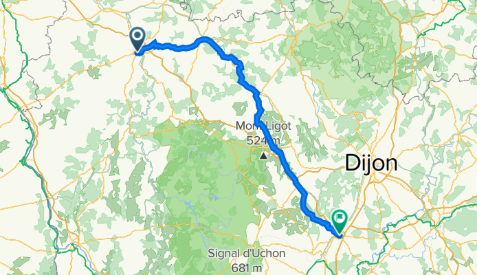
4-Auxerre - Beaune 174 Km
A cycling route starting in Auxerre, Bourgogne-Franche-Comté, France.
Overview
About this route
- -:--
- Duration
- 174 km
- Distance
- 1,856 m
- Ascent
- 1,757 m
- Descent
- ---
- Avg. speed
- 578 m
- Avg. speed
Route quality
Waytypes & surfaces along the route
Waytypes
Busy road
131.2 km
(75 %)
Road
21.3 km
(12 %)
Surfaces
Paved
124.4 km
(72 %)
Unpaved
2.4 km
(1 %)
Asphalt
121.8 km
(70 %)
Paved (undefined)
2.7 km
(2 %)
Continue with Bikemap
Use, edit, or download this cycling route
You would like to ride 4-Auxerre - Beaune 174 Km or customize it for your own trip? Here is what you can do with this Bikemap route:
Free features
- Save this route as favorite or in collections
- Copy & plan your own version of this route
- Sync your route with Garmin or Wahoo
Premium features
Free trial for 3 days, or one-time payment. More about Bikemap Premium.
- Navigate this route on iOS & Android
- Export a GPX / KML file of this route
- Create your custom printout (try it for free)
- Download this route for offline navigation
Discover more Premium features.
Get Bikemap PremiumFrom our community
Other popular routes starting in Auxerre
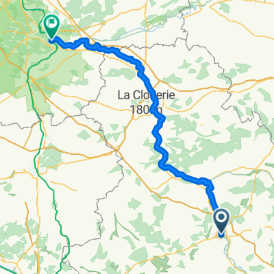
 Parcours n° 1
- Distance
- 54.7 km
- Ascent
- 381 m
- Descent
- 380 m
- Location
- Auxerre, Bourgogne-Franche-Comté, France
 Burgund - Auxerre - Yonne - Canal de Nivernais
- Distance
- 49.7 km
- Ascent
- 389 m
- Descent
- 348 m
- Location
- Auxerre, Bourgogne-Franche-Comté, France
 Girolibero: Il Canale di Borgogna e del Nivernais
- Distance
- 257.3 km
- Ascent
- 1,120 m
- Descent
- 995 m
- Location
- Auxerre, Bourgogne-Franche-Comté, France
 Canal du Nivernais with POI
- Distance
- 183.2 km
- Ascent
- 331 m
- Descent
- 237 m
- Location
- Auxerre, Bourgogne-Franche-Comté, France
 From Sens to Samoreau
- Distance
- 129.4 km
- Ascent
- 250 m
- Descent
- 307 m
- Location
- Auxerre, Bourgogne-Franche-Comté, France
 Route to Commelle-Vernay
- Distance
- 404 km
- Ascent
- 1,446 m
- Descent
- 1,445 m
- Location
- Auxerre, Bourgogne-Franche-Comté, France
 Quai de la Marine, Auxerre to rest. du canal ,Migennes
- Distance
- 25.4 km
- Ascent
- 40 m
- Descent
- 58 m
- Location
- Auxerre, Bourgogne-Franche-Comté, France
 Parcours Casse-pattes dans le Chablisien
- Distance
- 76 km
- Ascent
- 861 m
- Descent
- 859 m
- Location
- Auxerre, Bourgogne-Franche-Comté, France
Open it in the app