
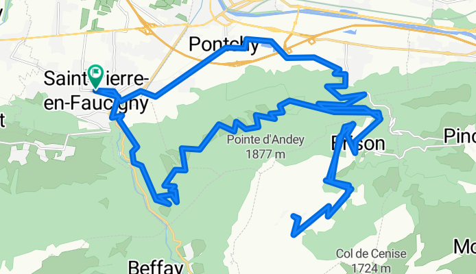
Col de Solaison via Sommet d'Andey
A cycling route starting in Amancy, Auvergne-Rhône-Alpes, France.
Overview
About this route
Too much snow for race bike until May... otherwise OK
Strecthes at 20%
- -:--
- Duration
- 40 km
- Distance
- 1,862 m
- Ascent
- 1,849 m
- Descent
- ---
- Avg. speed
- 1,510 m
- Avg. speed

Route quality
Waytypes & surfaces along the route
Waytypes
Road
24.7 km
(62 %)
Quiet road
13.9 km
(35 %)
Surfaces
Paved
20 km
(50 %)
Unpaved
0.8 km
(2 %)
Asphalt
20 km
(50 %)
Gravel
0.8 km
(2 %)
Undefined
19.3 km
(48 %)
Route highlights
Points of interest along the route
Point of interest after 8.6 km
Somet d'Andey
Point of interest after 20.8 km
Solaison
Continue with Bikemap
Use, edit, or download this cycling route
You would like to ride Col de Solaison via Sommet d'Andey or customize it for your own trip? Here is what you can do with this Bikemap route:
Free features
- Save this route as favorite or in collections
- Copy & plan your own version of this route
- Sync your route with Garmin or Wahoo
Premium features
Free trial for 3 days, or one-time payment. More about Bikemap Premium.
- Navigate this route on iOS & Android
- Export a GPX / KML file of this route
- Create your custom printout (try it for free)
- Download this route for offline navigation
Discover more Premium features.
Get Bikemap PremiumFrom our community
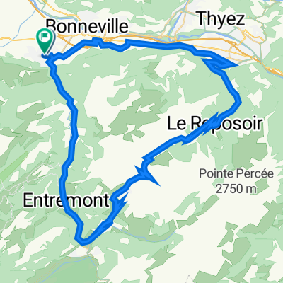
Other popular routes starting in Amancy
 Jérôme26200_Tour_Haute_Savoie
- Distance
- 127.9 km
- Ascent
- 2,097 m
- Descent
- 2,097 m
- Location
- Amancy, Auvergne-Rhône-Alpes, France
 La Roche sur F naar Neydens V2
- Distance
- 102.7 km
- Ascent
- 2,100 m
- Descent
- 2,005 m
- Location
- Amancy, Auvergne-Rhône-Alpes, France
 436–504 Avenue de la République, Saint-Pierre-en-Faucigny à 54 Place de l'Église, Saint-Pierre-en-Faucigny
- Distance
- 64.6 km
- Ascent
- 1,638 m
- Descent
- 1,642 m
- Location
- Amancy, Auvergne-Rhône-Alpes, France
 Chemin du Peuplier, Arenthon à Route des Bois des Fornets, La Roche-sur-Foron
- Distance
- 4.6 km
- Ascent
- 106 m
- Descent
- 0 m
- Location
- Amancy, Auvergne-Rhône-Alpes, France
 St Pierre en faucigny - Col de la Colombière
- Distance
- 32.1 km
- Ascent
- 1,246 m
- Descent
- 104 m
- Location
- Amancy, Auvergne-Rhône-Alpes, France
 grand bornar
- Distance
- 123.4 km
- Ascent
- 2,930 m
- Descent
- 2,394 m
- Location
- Amancy, Auvergne-Rhône-Alpes, France
 Col de Sur Cou and Col des Chasseurs
- Distance
- 35.4 km
- Ascent
- 1,211 m
- Descent
- 1,211 m
- Location
- Amancy, Auvergne-Rhône-Alpes, France
 Col de La Colombière - Col des Aravis
- Distance
- 84.6 km
- Ascent
- 1,855 m
- Descent
- 1,852 m
- Location
- Amancy, Auvergne-Rhône-Alpes, France
Open it in the app