

ROZHLEDNA PODVRSI, por Blansko
A cycling route starting in Blansko, South Moravian, Czechia.
Overview
About this route
Subida.
- -:--
- Duration
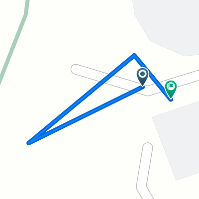
- 10.8 km
- Distance
- 378 m
- Ascent
- 81 m
- Descent
- ---
- Avg. speed
- 587 m
- Avg. speed

Route quality
Waytypes & surfaces along the route
Waytypes
Road
9.8 km
(91 %)
Quiet road
0.8 km
(7 %)
Surfaces
Paved
10.6 km
(98 %)
Unpaved
0.2 km
(2 %)
Asphalt
10.6 km
(98 %)
Loose gravel
0.2 km
(2 %)
Undefined
0 km
(<1 %)
Continue with Bikemap
Use, edit, or download this cycling route
You would like to ride ROZHLEDNA PODVRSI, por Blansko or customize it for your own trip? Here is what you can do with this Bikemap route:
Free features
- Save this route as favorite or in collections
- Copy & plan your own version of this route
- Sync your route with Garmin or Wahoo
Premium features
Free trial for 3 days, or one-time payment. More about Bikemap Premium.
- Navigate this route on iOS & Android
- Export a GPX / KML file of this route
- Create your custom printout (try it for free)
- Download this route for offline navigation
Discover more Premium features.
Get Bikemap PremiumFrom our community
Other popular routes starting in Blansko
 1 - 1
1 - 1- Distance
- 64.3 km
- Ascent
- 788 m
- Descent
- 680 m
- Location
- Blansko, South Moravian, Czechia
 13. Májovka
- Distance
- 46.9 km
- Ascent
- 781 m
- Descent
- 781 m
- Location
- Blansko, South Moravian, Czechia
 Brief bike tour through Blansko
- Distance
- 0.1 km
- Ascent
- 0 m
- Descent
- 0 m
- Location
- Blansko, South Moravian, Czechia
 Cetkovická čtyřicítka
- Distance
- 43.2 km
- Ascent
- 742 m
- Descent
- 658 m
- Location
- Blansko, South Moravian, Czechia
 Trojstoupačka na Babí lom
- Distance
- 28.4 km
- Ascent
- 708 m
- Descent
- 708 m
- Location
- Blansko, South Moravian, Czechia
 9. Březnová rozcvička
- Distance
- 20.5 km
- Ascent
- 502 m
- Descent
- 270 m
- Location
- Blansko, South Moravian, Czechia
 Blansko
- Distance
- 60.2 km
- Ascent
- 622 m
- Descent
- 620 m
- Location
- Blansko, South Moravian, Czechia
 Blansko-Adamov-Křtiny-Vilémovice-Blansko
- Distance
- 50 km
- Ascent
- 595 m
- Descent
- 595 m
- Location
- Blansko, South Moravian, Czechia
Open it in the app