

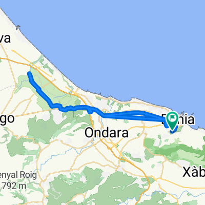
Via Verde - Denia
A cycling route starting in Denia, Valencia, Spain.
Overview
About this route
Camino de la Antigua via del tren, reacondicionado muy bien, es completamente llano, sale al lado de los Viveros Natura. A ver el edifico del antiguo apeadero del Palmar. Se supone que se pude seguir hasta los marjales de Pego según indicaciones en la zona de descanso ¡¡BUENA INICIATIVA DEL AYTO:!!
La vuelta es la misma.
- -:--
- Duration
- 7.4 km
- Distance
- 21 m
- Ascent
- 6 m
- Descent
- ---
- Avg. speed
- ---
- Avg. speed
Continue with Bikemap
Use, edit, or download this cycling route
You would like to ride Via Verde - Denia or customize it for your own trip? Here is what you can do with this Bikemap route:
Free features
- Save this route as favorite or in collections
- Copy & plan your own version of this route
- Sync your route with Garmin or Wahoo
Premium features
Free trial for 3 days, or one-time payment. More about Bikemap Premium.
- Navigate this route on iOS & Android
- Export a GPX / KML file of this route
- Create your custom printout (try it for free)
- Download this route for offline navigation
Discover more Premium features.
Get Bikemap PremiumFrom our community
Other popular routes starting in Denia
 Denia-Parcent-Benixembla-Benimaurell-Orba-Beniarbeig-Pedreguer-Denia
- Distance
- 69.9 km
- Ascent
- 836 m
- Descent
- 826 m
- Location
- Denia, Valencia, Spain
 Ruta hacia la Font Salada.
- Distance
- 42.6 km
- Ascent
- 64 m
- Descent
- 64 m
- Location
- Denia, Valencia, Spain
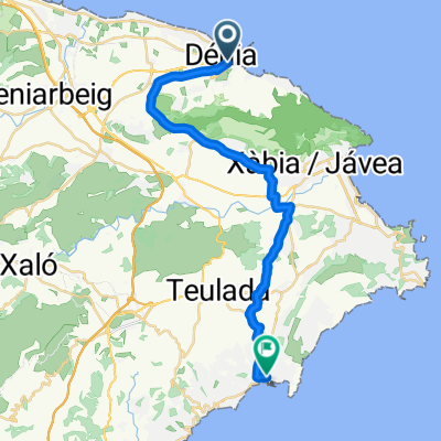 Dénia - Moraira
- Distance
- 27.6 km
- Ascent
- 354 m
- Descent
- 355 m
- Location
- Denia, Valencia, Spain
 Denia Day 1 Pego
- Distance
- 74.5 km
- Ascent
- 376 m
- Descent
- 375 m
- Location
- Denia, Valencia, Spain
 Cova del Camell
- Distance
- 5.7 km
- Ascent
- 444 m
- Descent
- 361 m
- Location
- Denia, Valencia, Spain
 2016-08agosto-13 - FAMORCA
- Distance
- 108.2 km
- Ascent
- 1,033 m
- Descent
- 1,032 m
- Location
- Denia, Valencia, Spain
 156 km - Denia-Rates-Guadalest-Gorga-Toios-Ebo-Tormos-Orba-Denia
- Distance
- 156.4 km
- Ascent
- 1,948 m
- Descent
- 1,940 m
- Location
- Denia, Valencia, Spain
 ruta de montaña
- Distance
- 9.9 km
- Ascent
- 778 m
- Descent
- 716 m
- Location
- Denia, Valencia, Spain
Open it in the app