

Radweg Berlin bzw. Zossen - Leipzig
A cycling route starting in Zossen, Brandenburg, Germany.
Overview
About this route
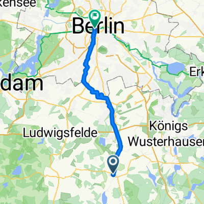
Berlin, Brandenburger Tor - Berlin, Bahnhof Südkreuz - Berlin-Lankwitz - Berlin, Grenze nach Mahlow - Berlin-Lichtenrade, S-Bahn - Glasow - Zossen - Mellensee - Rehagen - Sperenberg - Kummersdorf-Gut - Schönefeld - Stülpe - Holbeck - Jänickendorf (Nuthe-Urstromtal) - Neuhof - Werder - Jüterbog - Neues Lager - Dennewitz - Seehausen - Zahna - Bülzig - Zörnigall - Mühlanger - Lutherstadt Wittenberg - Kienberge - Klitzschena - Bergwitz - Reuden - Kemberg - Lubast - Sackwitzer Mühle - Reinharz - Großwig - Bad Schmiedeberg - Hammermühle - Bad Düben - Wellaune - Noitzsch - Klein-Mölkau - Kupsal - Merkwitz - Plaußig - Thekla - Schönefeld-Abtnaundorf - Leipzig, Hbf / (Gesamtlänge: ca.250 km)
- -:--
- Duration
- 189.2 km
- Distance
- 848 m
- Ascent
- 775 m
- Descent
- ---
- Avg. speed
- 180 m
- Avg. speed
Route quality
Waytypes & surfaces along the route
Waytypes
Path
42.5 km
(22 %)
Quiet road
39.6 km
(21 %)
Surfaces
Paved
138.7 km
(73 %)
Unpaved
29.5 km
(16 %)
Asphalt
126.6 km
(67 %)
Gravel
14.2 km
(8 %)
Continue with Bikemap
Use, edit, or download this cycling route
You would like to ride Radweg Berlin bzw. Zossen - Leipzig or customize it for your own trip? Here is what you can do with this Bikemap route:
Free features
- Save this route as favorite or in collections
- Copy & plan your own version of this route
- Sync your route with Garmin or Wahoo
Premium features
Free trial for 3 days, or one-time payment. More about Bikemap Premium.
- Navigate this route on iOS & Android
- Export a GPX / KML file of this route
- Create your custom printout (try it for free)
- Download this route for offline navigation
Discover more Premium features.
Get Bikemap PremiumFrom our community
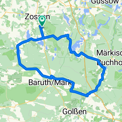
Other popular routes starting in Zossen
 perm Glashütte
- Distance
- 78.4 km
- Ascent
- 285 m
- Descent
- 283 m
- Location
- Zossen, Brandenburg, Germany
 Zossen Mellensee 36 km
- Distance
- 35.6 km
- Ascent
- 79 m
- Descent
- 79 m
- Location
- Zossen, Brandenburg, Germany
 Zossen Berlin
- Distance
- 43.7 km
- Ascent
- 51 m
- Descent
- 52 m
- Location
- Zossen, Brandenburg, Germany
 Rundweg Zossen CLONED FROM ROUTE 144655
- Distance
- 39.2 km
- Ascent
- 108 m
- Descent
- 107 m
- Location
- Zossen, Brandenburg, Germany
 Zossen/Klausdorf/Wünsdorf
- Distance
- 23.4 km
- Ascent
- 20 m
- Descent
- 20 m
- Location
- Zossen, Brandenburg, Germany
 perm Baruther Rund
- Distance
- 83.5 km
- Ascent
- 232 m
- Descent
- 231 m
- Location
- Zossen, Brandenburg, Germany
 Zossen - Brandenburg
- Distance
- 77.4 km
- Ascent
- 206 m
- Descent
- 217 m
- Location
- Zossen, Brandenburg, Germany
 Von Zossen via Diedersdorf nach Blankenfelde
- Distance
- 29.8 km
- Ascent
- 50 m
- Descent
- 70 m
- Location
- Zossen, Brandenburg, Germany
Open it in the app