

Flachetappe
A cycling route starting in Oerlinghausen, North Rhine-Westphalia, Germany.
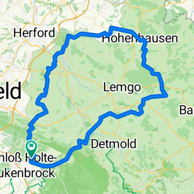
Overview
About this route
Flat stage from
Schloß Holte
Hövelhof Sande Delbrück Rietberg Verl
Schloß Holte
- -:--
- Duration
- 69.7 km
- Distance
- 104 m
- Ascent
- 126 m
- Descent
- ---
- Avg. speed
- 127 m
- Max. altitude
Route quality
Waytypes & surfaces along the route
Waytypes
Quiet road
34.8 km
(50 %)
Path
11.8 km
(17 %)
Surfaces
Paved
62.7 km
(90 %)
Unpaved
1.4 km
(2 %)
Asphalt
62.7 km
(90 %)
Unpaved (undefined)
0.7 km
(1 %)
Continue with Bikemap
Use, edit, or download this cycling route
You would like to ride Flachetappe or customize it for your own trip? Here is what you can do with this Bikemap route:
Free features
- Save this route as favorite or in collections
- Copy & plan your own version of this route
- Sync your route with Garmin or Wahoo
Premium features
Free trial for 3 days, or one-time payment. More about Bikemap Premium.
- Navigate this route on iOS & Android
- Export a GPX / KML file of this route
- Create your custom printout (try it for free)
- Download this route for offline navigation
Discover more Premium features.
Get Bikemap PremiumFrom our community
Other popular routes starting in Oerlinghausen
 Sennestadt - Gütersloh
- Distance
- 47.5 km
- Ascent
- 1,213 m
- Descent
- 1,207 m
- Location
- Oerlinghausen, North Rhine-Westphalia, Germany
 Flugplatz Stukenbrock Rundroute
- Distance
- 24.4 km
- Ascent
- 359 m
- Descent
- 359 m
- Location
- Oerlinghausen, North Rhine-Westphalia, Germany
 Oerlinghausen Radfahren
- Distance
- 32.7 km
- Ascent
- 298 m
- Descent
- 295 m
- Location
- Oerlinghausen, North Rhine-Westphalia, Germany
 Oerlinghausen Radfahren
- Distance
- 54.1 km
- Ascent
- 82 m
- Descent
- 82 m
- Location
- Oerlinghausen, North Rhine-Westphalia, Germany
 MTB - Runde
- Distance
- 41 km
- Ascent
- 540 m
- Descent
- 537 m
- Location
- Oerlinghausen, North Rhine-Westphalia, Germany
 22.3.11 Bienenschmidt
- Distance
- 29.4 km
- Ascent
- 221 m
- Descent
- 224 m
- Location
- Oerlinghausen, North Rhine-Westphalia, Germany
 MTB zum Hermannsdenkmal und Externsteine
- Distance
- 52.6 km
- Ascent
- 899 m
- Descent
- 899 m
- Location
- Oerlinghausen, North Rhine-Westphalia, Germany
 Oh,wie schön ist OWL
- Distance
- 98.6 km
- Ascent
- 705 m
- Descent
- 704 m
- Location
- Oerlinghausen, North Rhine-Westphalia, Germany
Open it in the app