Premium Badge Download on the App Store Get it on Google Play Turn-by-turn Navigation Offline Maps Bike Type Optimized Routing Premium Maps Custom Bike Computer Export Routes Route Previews Fall Detection Premium Support

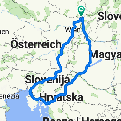
Cycling Route in Břeclav, South Moravian, Czechia

Břeclavsko 01

1
Open this route in the Bikemap app

Open this route in the Bikemap app

Open this route in Bikemap Web

Open this route in Bikemap Web

65 km
Distance
280 m
Ascent
280 m
Descent
-:-- h
Duration
-- km/h
Avg. Speed
--- m
Max. Elevation

About This Route

6.9.2008

BŘECLAV – LEDNICE – BULHARY – NOVÉ MLÝNY - DOLNÍ VĚSTONICE – BAVORY – MIKULOV – HLOHOVEC - BŘECLAV

Břeclav – po 41 – asfalt – alejí – lesem – Janův hrad – zpět po 41 – Lednice – zámek – městem – po Mikulovské cestě – 5043 – lesem – podél Dyje – Bulhary – stoupání – sjezd – Nové Mlýny – podél přehrady – Dolní Věstonice – po silnici 5044 – Horní Věstonice – dále po 5043 – stoupání – Spálená Hospoda – Perná – doprava vesnicí – Bavory – dlouhé stoupání – sjezd – Mikulov – městem – Mikulovská cesta – podél trati – Sedlec – po 41 – rybníky – Nesyt – Hlohovec – chrám Tří Grácií – dále lesem – Apollónův chrám – silnice – Valtická alej – doprava – po 41 - Břeclav

This cycling route is ideal for: MTB

You will cycle on the following surfaces: Paved Gravel

Customize this cycling route with the Bikemap route planner.

Make it yours!

Did you know? You can use this route as a template in our cycling route planner if you don't wish to start from scratch. Customize it based on your needs to plan your perfect cycling tour.

Open it in the app