

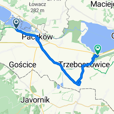
Gościce do Główna 20A, Bardo
A cycling route starting in Kamienica, Opole Voivodeship, Poland.
Overview
About this route
- 5 h 54 min
- Duration
- 51.3 km
- Distance
- 1,615 m
- Ascent
- 1,623 m
- Descent
- 8.7 km/h
- Avg. speed
- 752 m
- Max. altitude

Route quality
Waytypes & surfaces along the route
Waytypes
Track
23 km
(45 %)
Road
10.7 km
(21 %)
Surfaces
Paved
19.4 km
(38 %)
Unpaved
19.9 km
(39 %)
Asphalt
14.3 km
(28 %)
Ground
8 km
(16 %)
Continue with Bikemap
Use, edit, or download this cycling route
You would like to ride Gościce do Główna 20A, Bardo or customize it for your own trip? Here is what you can do with this Bikemap route:
Free features
- Save this route as favorite or in collections
- Copy & plan your own version of this route
- Sync your route with Garmin or Wahoo
Premium features
Free trial for 3 days, or one-time payment. More about Bikemap Premium.
- Navigate this route on iOS & Android
- Export a GPX / KML file of this route
- Create your custom printout (try it for free)
- Download this route for offline navigation
Discover more Premium features.
Get Bikemap PremiumFrom our community
Other popular routes starting in Kamienica
 d2_asfalt-40km_Paczkow-Javornik-Stronie
- Distance
- 38.1 km
- Ascent
- 610 m
- Descent
- 327 m
- Location
- Kamienica, Opole Voivodeship, Poland
 Borůvková hora - Těchonín
- Distance
- 90.5 km
- Ascent
- 1,168 m
- Descent
- 1,015 m
- Location
- Kamienica, Opole Voivodeship, Poland
 Blotnica - Paczkow - StronieSlaskie
- Distance
- 44.6 km
- Ascent
- 661 m
- Descent
- 371 m
- Location
- Kamienica, Opole Voivodeship, Poland
 trasaNieśpieszny przejazd w
- Distance
- 18.9 km
- Ascent
- 77 m
- Descent
- 112 m
- Location
- Kamienica, Opole Voivodeship, Poland
 d2_Blotnica-StaraMorawa
- Distance
- 39.3 km
- Ascent
- 570 m
- Descent
- 283 m
- Location
- Kamienica, Opole Voivodeship, Poland
 Kozielno do Ścibórz
- Distance
- 19.7 km
- Ascent
- 122 m
- Descent
- 181 m
- Location
- Kamienica, Opole Voivodeship, Poland
 Pa 14. 8 Kozielno Glucholazy po EV 9 67 km
- Distance
- 67 km
- Ascent
- 238 m
- Descent
- 183 m
- Location
- Kamienica, Opole Voivodeship, Poland
 Silnička - Rychlebské hory
- Distance
- 86.6 km
- Ascent
- 544 m
- Descent
- 544 m
- Location
- Kamienica, Opole Voivodeship, Poland
Open it in the app