
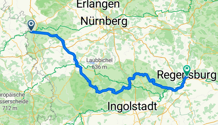
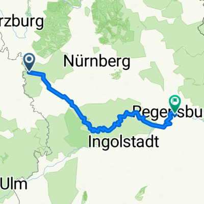
Girolibero: Ciclabile dell'Altmühl
A cycling route starting in Rothenburg upon Tauber, Bavaria, Germany.
Overview
About this route
Pernottamenti: Rothenburg, Ansbach, Wettelsheim bei Treutlingen, Eichstätt, Beilngries, Regensburg.
Percorso: percorso quasi interamente pianeggiante in pista ciclabile, solo nelle prime due tappe ci sono un paio di brevi salite. La ciclabile è ben segnalata e mantenuta.- -:--
- Duration
- 234.2 km
- Distance
- 1,638 m
- Ascent
- 1,708 m
- Descent
- ---
- Avg. speed
- 553 m
- Avg. speed

Route quality
Waytypes & surfaces along the route
Waytypes
Busy road
135 km
(58 %)
Road
33.7 km
(14 %)
Surfaces
Paved
190.4 km
(81 %)
Unpaved
12 km
(5 %)
Asphalt
185.8 km
(79 %)
Loose gravel
6.8 km
(3 %)
Route highlights
Points of interest along the route
Accommodation after 37.4 km
Ansbach
Accommodation after 83.8 km
Wettelsheim
Accommodation after 124.2 km
Eichstätt
Accommodation after 163.3 km
Beilngries
Continue with Bikemap
Use, edit, or download this cycling route
You would like to ride Girolibero: Ciclabile dell'Altmühl or customize it for your own trip? Here is what you can do with this Bikemap route:
Free features
- Save this route as favorite or in collections
- Copy & plan your own version of this route
- Sync your route with Garmin or Wahoo
Premium features
Free trial for 3 days, or one-time payment. More about Bikemap Premium.
- Navigate this route on iOS & Android
- Export a GPX / KML file of this route
- Create your custom printout (try it for free)
- Download this route for offline navigation
Discover more Premium features.
Get Bikemap PremiumFrom our community
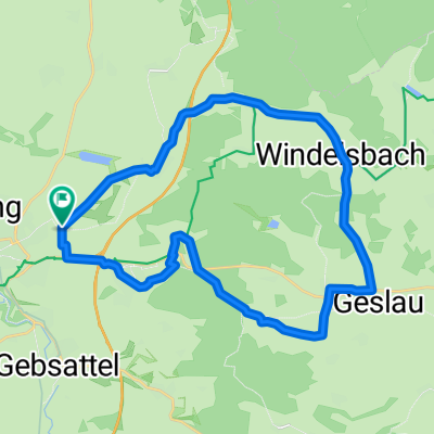
Other popular routes starting in Rothenburg upon Tauber
 altmühltal
- Distance
- 137.4 km
- Ascent
- 496 m
- Descent
- 540 m
- Location
- Rothenburg upon Tauber, Bavaria, Germany
 Rothenburg to Bamberg
- Distance
- 120.8 km
- Ascent
- 98 m
- Descent
- 285 m
- Location
- Rothenburg upon Tauber, Bavaria, Germany
 Rund um Rothenburg
- Distance
- 23.1 km
- Ascent
- 463 m
- Descent
- 445 m
- Location
- Rothenburg upon Tauber, Bavaria, Germany
 Paneuropa radweg (alternative german part)
- Distance
- 36 km
- Ascent
- 498 m
- Descent
- 580 m
- Location
- Rothenburg upon Tauber, Bavaria, Germany
 Rothenburg-Tauberquelle
- Distance
- 44.7 km
- Ascent
- 278 m
- Descent
- 278 m
- Location
- Rothenburg upon Tauber, Bavaria, Germany
 Rothenburg-Regensburg
- Distance
- 263.4 km
- Ascent
- 1,292 m
- Descent
- 1,373 m
- Location
- Rothenburg upon Tauber, Bavaria, Germany
 Route zu Kaufland
- Distance
- 2.6 km
- Ascent
- 115 m
- Descent
- 24 m
- Location
- Rothenburg upon Tauber, Bavaria, Germany
 Frankenhöhe
- Distance
- 25 km
- Ascent
- 219 m
- Descent
- 224 m
- Location
- Rothenburg upon Tauber, Bavaria, Germany
Open it in the app