

Komárno _ Štúrovo
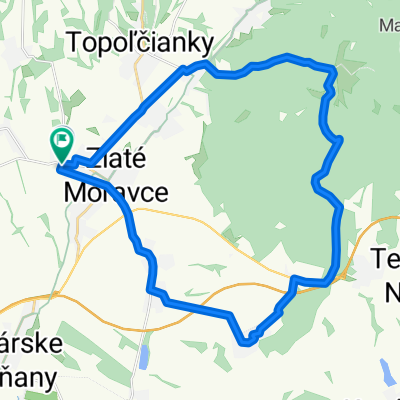
A cycling route starting in Zlaté Moravce, Nitriansky kraj, Slovak Republic.
Overview
About this route
najdlhšia naša etapa v priebehu 1 dňa
- -:--
- Duration
- 231.4 km
- Distance
- 316 m
- Ascent
- 316 m
- Descent
- ---
- Avg. speed
- ---
- Avg. speed

Route quality
Waytypes & surfaces along the route
Waytypes
Busy road
101.9 km
(44 %)
Road
78.7 km
(34 %)
Surfaces
Paved
101 km
(44 %)
Unpaved
6.5 km
(3 %)
Asphalt
97 km
(42 %)
Ground
5.6 km
(2 %)
Route highlights
Points of interest along the route
Point of interest after 65.6 km
Hvezdáreň
Point of interest after 65.7 km
Hvezdáreň - Hlavný vchod
Point of interest after 80.4 km
Dosiahnutý cieľ - Komárno
Point of interest after 81.9 km
Múzeum
Point of interest after 82 km
Pešia zóna
Point of interest after 93.6 km
Zbytky rímskeho vojenského tábora Kelemantia
Point of interest after 93.8 km
Piesočná pláž na Dunaji
Point of interest after 152.8 km
Nočný pohľad na Ostrihomský most
Continue with Bikemap
Use, edit, or download this cycling route
You would like to ride Komárno _ Štúrovo or customize it for your own trip? Here is what you can do with this Bikemap route:
Free features
- Save this route as favorite or in collections
- Copy & plan your own version of this route
- Sync your route with Garmin or Wahoo
Premium features
Free trial for 3 days, or one-time payment. More about Bikemap Premium.
- Navigate this route on iOS & Android
- Export a GPX / KML file of this route
- Create your custom printout (try it for free)
- Download this route for offline navigation
Discover more Premium features.
Get Bikemap PremiumFrom our community
Other popular routes starting in Zlaté Moravce
 SpartaBikeTrip - 2015 / 4447 km
- Distance
- 4,377 km
- Ascent
- 4,353 m
- Descent
- 4,350 m
- Location
- Zlaté Moravce, Nitriansky kraj, Slovak Republic
 Tribeč
- Distance
- 18.4 km
- Ascent
- 561 m
- Descent
- 557 m
- Location
- Zlaté Moravce, Nitriansky kraj, Slovak Republic
 Vrchhora kláštor
- Distance
- 32.8 km
- Ascent
- 436 m
- Descent
- 208 m
- Location
- Zlaté Moravce, Nitriansky kraj, Slovak Republic
 Zlaté Moravce - Topoľčianky - Hrad Hrušov
- Distance
- 28.5 km
- Ascent
- 323 m
- Descent
- 324 m
- Location
- Zlaté Moravce, Nitriansky kraj, Slovak Republic
 ZM- Tes.Mlyňany- Arborétum Mlyňany - Vozokany
- Distance
- 24.4 km
- Ascent
- 135 m
- Descent
- 137 m
- Location
- Zlaté Moravce, Nitriansky kraj, Slovak Republic
 Kráľ kopcov
- Distance
- 30.9 km
- Ascent
- 532 m
- Descent
- 534 m
- Location
- Zlaté Moravce, Nitriansky kraj, Slovak Republic
 ZM- Slažany- Velčice- Mankovce- Martin n.Žitavou
- Distance
- 18.5 km
- Ascent
- 177 m
- Descent
- 177 m
- Location
- Zlaté Moravce, Nitriansky kraj, Slovak Republic
 Nitra cyklomaraton
- Distance
- 137.7 km
- Ascent
- 1,506 m
- Descent
- 1,506 m
- Location
- Zlaté Moravce, Nitriansky kraj, Slovak Republic
Open it in the app