

Fränkische Täler
A cycling route starting in Pegnitz, Bavaria, Germany.
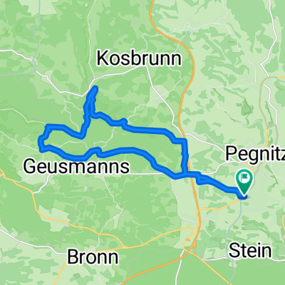
Overview
About this route
Die Strecke ist unter der Woche ratsam, da man den Wochenedausflugsverkehr aus dem Wege geht. Sonnige Abschnitte und waldreiche Stücke machen den Weg abwechslungsreich. Am Afang etwas hügelig, später flach macht die Fahrt durch das Wiesenttal viel Spaß. Einkehrmöglichkeiten finden sich reichlich.
- -:--
- Duration
- 103.6 km
- Distance
- 641 m
- Ascent
- 641 m
- Descent
- ---
- Avg. speed
- ---
- Avg. speed

Continue with Bikemap
Use, edit, or download this cycling route
You would like to ride Fränkische Täler or customize it for your own trip? Here is what you can do with this Bikemap route:
Free features
- Save this route as favorite or in collections
- Copy & plan your own version of this route
- Sync your route with Garmin or Wahoo
Premium features
Free trial for 3 days, or one-time payment. More about Bikemap Premium.
- Navigate this route on iOS & Android
- Export a GPX / KML file of this route
- Create your custom printout (try it for free)
- Download this route for offline navigation
Discover more Premium features.
Get Bikemap PremiumFrom our community
Other popular routes starting in Pegnitz
 Veldensteiner Forst - Burg Hartenstein
- Distance
- 48.7 km
- Ascent
- 590 m
- Descent
- 587 m
- Location
- Pegnitz, Bavaria, Germany
 Runde nach Königsstein
- Distance
- 56.6 km
- Ascent
- 521 m
- Descent
- 518 m
- Location
- Pegnitz, Bavaria, Germany
 Pegnitz Weidlwang Horlach
- Distance
- 20.6 km
- Ascent
- 244 m
- Descent
- 243 m
- Location
- Pegnitz, Bavaria, Germany
 Pegnitz - Wander
- Distance
- 4 km
- Ascent
- 117 m
- Descent
- 115 m
- Location
- Pegnitz, Bavaria, Germany
 Veldensteiner Forst Runde
- Distance
- 45.1 km
- Ascent
- 535 m
- Descent
- 535 m
- Location
- Pegnitz, Bavaria, Germany
 Pegnitz-Weiglathal-Leups-Pegnitz
- Distance
- 55.8 km
- Ascent
- 788 m
- Descent
- 786 m
- Location
- Pegnitz, Bavaria, Germany
 Rundweg Pegnitz Elbersberg Hollenberg
- Distance
- 19.2 km
- Ascent
- 332 m
- Descent
- 332 m
- Location
- Pegnitz, Bavaria, Germany
 Pegnitz - Bayreuth
- Distance
- 90.7 km
- Ascent
- 570 m
- Descent
- 652 m
- Location
- Pegnitz, Bavaria, Germany
Open it in the app