

Coupierte Route Mühleberg-Chasseral-Mühleberg
A cycling route starting in Mühleberg, Canton of Bern, Switzerland.
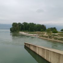
Overview
About this route
Coupierte Rundtour Mühleberg, Kerzers, Ins, Erlach, La Neuville, Chasseral, Sanit-Imier, Corgémont, Biel, Ins, Tschugg, Kerzers, Mühleberg
- -:--
- Duration
- 126.9 km
- Distance
- 1,810 m
- Ascent
- 1,873 m
- Descent
- ---
- Avg. speed
- 1,549 m
- Avg. speed

Route quality
Waytypes & surfaces along the route
Waytypes
Busy road
62.8 km
(49 %)
Road
27.8 km
(22 %)
Surfaces
Paved
73 km
(58 %)
Unpaved
2.8 km
(2 %)
Asphalt
67.5 km
(53 %)
Paved (undefined)
5.4 km
(4 %)
Continue with Bikemap
Use, edit, or download this cycling route
You would like to ride Coupierte Route Mühleberg-Chasseral-Mühleberg or customize it for your own trip? Here is what you can do with this Bikemap route:
Free features
- Save this route as favorite or in collections
- Copy & plan your own version of this route
- Sync your route with Garmin or Wahoo
Premium features
Free trial for 3 days, or one-time payment. More about Bikemap Premium.
- Navigate this route on iOS & Android
- Export a GPX / KML file of this route
- Create your custom printout (try it for free)
- Download this route for offline navigation
Discover more Premium features.
Get Bikemap PremiumFrom our community
Other popular routes starting in Mühleberg
 bike tour from Mühleberg to Hinterkappelen
- Distance
- 11 km
- Ascent
- 168 m
- Descent
- 138 m
- Location
- Mühleberg, Canton of Bern, Switzerland
 Oberdorf 32, Wileroltigen nach Oberdorf 32, Wileroltigen
- Distance
- 51.4 km
- Ascent
- 238 m
- Descent
- 291 m
- Location
- Mühleberg, Canton of Bern, Switzerland
 Short ride through Mühleberg
- Distance
- 0.2 km
- Ascent
- 0 m
- Descent
- 0 m
- Location
- Mühleberg, Canton of Bern, Switzerland
 Coupierte Route Mühleberg-Chasseral-Mühleberg
- Distance
- 126.9 km
- Ascent
- 1,810 m
- Descent
- 1,873 m
- Location
- Mühleberg, Canton of Bern, Switzerland
 Trüllernstrasse 26, Gümmenen nach Trüllernstrasse 26, Gümmenen
- Distance
- 25.5 km
- Ascent
- 479 m
- Descent
- 475 m
- Location
- Mühleberg, Canton of Bern, Switzerland
 Mühleberg-Frienisberg-Wohlen-Riedbach
- Distance
- 41.8 km
- Ascent
- 732 m
- Descent
- 697 m
- Location
- Mühleberg, Canton of Bern, Switzerland
 Hagneck Stauwehr
- Distance
- 42.6 km
- Ascent
- 356 m
- Descent
- 356 m
- Location
- Mühleberg, Canton of Bern, Switzerland
 Rund um den Wohlensee
- Distance
- 44.6 km
- Ascent
- 609 m
- Descent
- 605 m
- Location
- Mühleberg, Canton of Bern, Switzerland
Open it in the app