

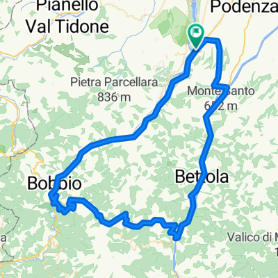
VAL Trebbia (Rivergaro-Bobbio)
A cycling route starting in Rivergaro, Emilia-Romagna, Italy.
Overview
About this route
- -:--
- Duration
- 63.9 km
- Distance
- 1,082 m
- Ascent
- 1,082 m
- Descent
- ---
- Avg. speed
- 406 m
- Avg. speed

Route quality
Waytypes & surfaces along the route
Waytypes
Busy road
22.6 km
(35 %)
Quiet road
22.4 km
(35 %)
Surfaces
Paved
12.1 km
(19 %)
Unpaved
0.8 km
(1 %)
Asphalt
9.5 km
(15 %)
Paved (undefined)
2.6 km
(4 %)
Continue with Bikemap
Use, edit, or download this cycling route
You would like to ride VAL Trebbia (Rivergaro-Bobbio) or customize it for your own trip? Here is what you can do with this Bikemap route:
Free features
- Save this route as favorite or in collections
- Copy & plan your own version of this route
- Sync your route with Garmin or Wahoo
Premium features
Free trial for 3 days, or one-time payment. More about Bikemap Premium.
- Navigate this route on iOS & Android
- Export a GPX / KML file of this route
- Create your custom printout (try it for free)
- Download this route for offline navigation
Discover more Premium features.
Get Bikemap PremiumFrom our community
Other popular routes starting in Rivergaro
 Statto-Pigazzano
- Distance
- 4 km
- Ascent
- 281 m
- Descent
- 14 m
- Location
- Rivergaro, Emilia-Romagna, Italy
 Giro dei Tossici e del Pillerone
- Distance
- 36.6 km
- Ascent
- 806 m
- Descent
- 806 m
- Location
- Rivergaro, Emilia-Romagna, Italy
 River-Mandrola-Pillerone
- Distance
- 34.8 km
- Ascent
- 812 m
- Descent
- 812 m
- Location
- Rivergaro, Emilia-Romagna, Italy
 Giro Italia _ Rivergaro - Varese Ligure
- Distance
- 219.6 km
- Ascent
- 4,317 m
- Descent
- 4,110 m
- Location
- Rivergaro, Emilia-Romagna, Italy
 Rivergaro - Pontedell'Olio - Farini - Pradovera - Coli - Bobbio - Rivergaro
- Distance
- 94.1 km
- Ascent
- 2,615 m
- Descent
- 2,562 m
- Location
- Rivergaro, Emilia-Romagna, Italy
 Rivergaro - Donceto - Pradovera - Filippazzi - Perino - Rivergaro
- Distance
- 66.1 km
- Ascent
- 2,426 m
- Descent
- 2,386 m
- Location
- Rivergaro, Emilia-Romagna, Italy
 MANDROLA BOSCO
- Distance
- 18.4 km
- Ascent
- 441 m
- Descent
- 441 m
- Location
- Rivergaro, Emilia-Romagna, Italy
 Rivergaro - Piacenza - Gossolengo - Statto - Rivergaro
- Distance
- 40.7 km
- Ascent
- 91 m
- Descent
- 103 m
- Location
- Rivergaro, Emilia-Romagna, Italy
Open it in the app