

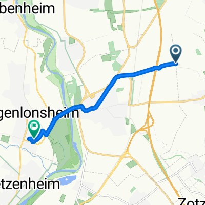
Aspisheim nach An der Ziegelhütte 19, Bingen am Rhein
A cycling route starting in Horrweiler, Rhineland-Palatinate, Germany.
Overview
About this route
- 5 min
- Duration
- 1.5 km
- Distance
- 13 m
- Ascent
- 13 m
- Descent
- 19.7 km/h
- Avg. speed
- 138 m
- Avg. speed

Route quality
Waytypes & surfaces along the route
Waytypes
Track
1.5 km
(100 %)
Surfaces
Paved
1.5 km
(100 %)
Asphalt
1.5 km
(100 %)
Continue with Bikemap
Use, edit, or download this cycling route
You would like to ride Aspisheim nach An der Ziegelhütte 19, Bingen am Rhein or customize it for your own trip? Here is what you can do with this Bikemap route:
Free features
- Save this route as favorite or in collections
- Copy & plan your own version of this route
- Sync your route with Garmin or Wahoo
Premium features
Free trial for 3 days, or one-time payment. More about Bikemap Premium.
- Navigate this route on iOS & Android
- Export a GPX / KML file of this route
- Create your custom printout (try it for free)
- Download this route for offline navigation
Discover more Premium features.
Get Bikemap PremiumFrom our community
Other popular routes starting in Horrweiler
 L 414, Bingen am Rhein nach Kegelbahnstraße 2, Ober-Hilbersheim
- Distance
- 6.8 km
- Ascent
- 163 m
- Descent
- 61 m
- Location
- Horrweiler, Rhineland-Palatinate, Germany
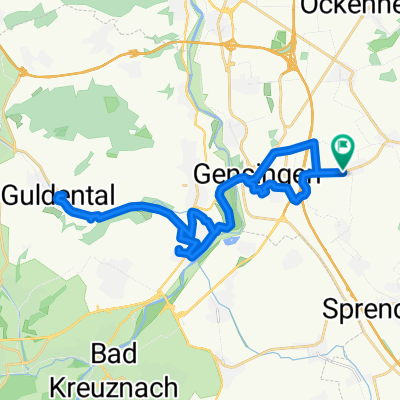 Gensinger Straße 12, Horrweiler nach Gensinger Straße 12, Horrweiler
- Distance
- 29.1 km
- Ascent
- 167 m
- Descent
- 164 m
- Location
- Horrweiler, Rhineland-Palatinate, Germany
 Aspisheim nach An der Ziegelhütte 19, Bingen am Rhein
- Distance
- 1.5 km
- Ascent
- 13 m
- Descent
- 13 m
- Location
- Horrweiler, Rhineland-Palatinate, Germany
 ?Horrweiler Finthen
- Distance
- 25.4 km
- Ascent
- 190 m
- Descent
- 160 m
- Location
- Horrweiler, Rhineland-Palatinate, Germany
 Col De Horrweiler Umgehung
- Distance
- 1.6 km
- Ascent
- 56 m
- Descent
- 8 m
- Location
- Horrweiler, Rhineland-Palatinate, Germany
 Horrweiler Laubenheim
- Distance
- 8.5 km
- Ascent
- 0 m
- Descent
- 60 m
- Location
- Horrweiler, Rhineland-Palatinate, Germany
 Route nach Joshua ebert
- Distance
- 13.2 km
- Ascent
- 140 m
- Descent
- 150 m
- Location
- Horrweiler, Rhineland-Palatinate, Germany
 Route nach Schillerstraße 26, Langenlonsheim
- Distance
- 5.4 km
- Ascent
- 41 m
- Descent
- 67 m
- Location
- Horrweiler, Rhineland-Palatinate, Germany