
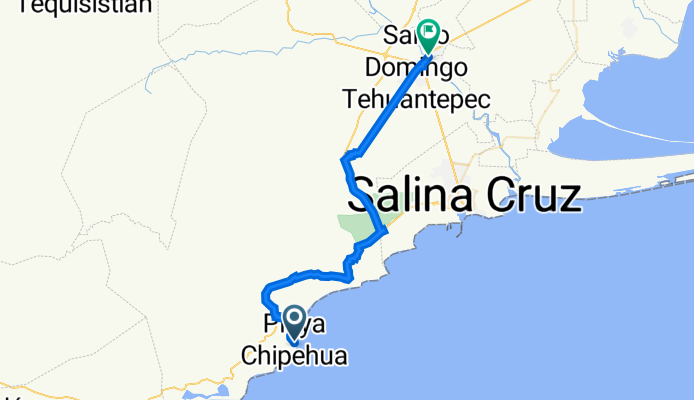
Chipehua - Tehuantepec
A cycling route starting in El Carrizal, Oaxaca, Mexico.
Overview
About this route
- -:--
- Duration
- 52.2 km
- Distance
- 597 m
- Ascent
- 571 m
- Descent
- ---
- Avg. speed
- 239 m
- Avg. speed

Continue with Bikemap
Use, edit, or download this cycling route
You would like to ride Chipehua - Tehuantepec or customize it for your own trip? Here is what you can do with this Bikemap route:
Free features
- Save this route as favorite or in collections
- Copy & plan your own version of this route
- Sync your route with Garmin or Wahoo
Premium features
Free trial for 3 days, or one-time payment. More about Bikemap Premium.
- Navigate this route on iOS & Android
- Export a GPX / KML file of this route
- Create your custom printout (try it for free)
- Download this route for offline navigation
Discover more Premium features.
Get Bikemap PremiumFrom our community
Other popular routes starting in El Carrizal
 Chipehua - Tehuantepec
- Distance
- 52.2 km
- Ascent
- 597 m
- Descent
- 571 m
- Location
- El Carrizal, Oaxaca, Mexico
 2010-03-08 Morro Mazatlán to Santo Domingo
- Distance
- 105.8 km
- Ascent
- 413 m
- Descent
- 392 m
- Location
- El Carrizal, Oaxaca, Mexico
 E51–Morro De Mazatlan–Barra De La Cruz
- Distance
- 92.7 km
- Ascent
- 679 m
- Descent
- 665 m
- Location
- El Carrizal, Oaxaca, Mexico
Open it in the app