

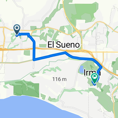
115–133 Burns Pl, Santa Barbara to 1440 Cook Pl, Santa Barbara
A cycling route starting in Goleta, California, United States of America.
Overview
About this route
- 50 min
- Duration
- 20.8 km
- Distance
- 44 m
- Ascent
- 41 m
- Descent
- 24.7 km/h
- Avg. speed
- 19 m
- Avg. speed
Route quality
Waytypes & surfaces along the route
Waytypes
Cycleway
16.4 km
(79 %)
Road
2 km
(9 %)
Surfaces
Paved
18.1 km
(87 %)
Asphalt
18 km
(87 %)
Wood
0.2 km
(<1 %)
Undefined
2.6 km
(13 %)
Continue with Bikemap
Use, edit, or download this cycling route
You would like to ride 115–133 Burns Pl, Santa Barbara to 1440 Cook Pl, Santa Barbara or customize it for your own trip? Here is what you can do with this Bikemap route:
Free features
- Save this route as favorite or in collections
- Copy & plan your own version of this route
- Sync your route with Garmin or Wahoo
Premium features
Free trial for 3 days, or one-time payment. More about Bikemap Premium.
- Navigate this route on iOS & Android
- Export a GPX / KML file of this route
- Create your custom printout (try it for free)
- Download this route for offline navigation
Discover more Premium features.
Get Bikemap PremiumFrom our community
Other popular routes starting in Goleta
 sb loop
- Distance
- 65.2 km
- Ascent
- 389 m
- Descent
- 392 m
- Location
- Goleta, California, United States of America
 Gibraltar and Painted Caves and OSM Ridge Route CLONED FROM ROUTE 1427172
- Distance
- 54.7 km
- Ascent
- 1,337 m
- Descent
- 1,338 m
- Location
- Goleta, California, United States of America
 Gibraltar and Painted Caves and OSM Ridge Route CLONED FROM ROUTE 1427172
- Distance
- 60.4 km
- Ascent
- 1,339 m
- Descent
- 1,353 m
- Location
- Goleta, California, United States of America
 5673 Surfrider Way, Goleta to 5673 Surfrider Way, Goleta
- Distance
- 13.8 km
- Ascent
- 55 m
- Descent
- 55 m
- Location
- Goleta, California, United States of America
 Westmoreland Pl, Goleta to State St, Santa Barbara
- Distance
- 11.1 km
- Ascent
- 76 m
- Descent
- 64 m
- Location
- Goleta, California, United States of America
 665 Ribera Dr, Santa Barbara to 930 Senda Verde, Santa Barbara
- Distance
- 7.8 km
- Ascent
- 69 m
- Descent
- 61 m
- Location
- Goleta, California, United States of America
 Cathedral
- Distance
- 10.2 km
- Ascent
- 109 m
- Descent
- 101 m
- Location
- Goleta, California, United States of America
 1470 N Fairview Ave, Goleta to 2201 Laguna St, Santa Barbara
- Distance
- 14 km
- Ascent
- 140 m
- Descent
- 135 m
- Location
- Goleta, California, United States of America