
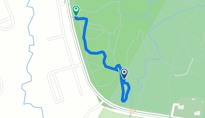
4600–4696 Greencastle Rd, Laurel to 4026–4038 Greencastle Rd, Burtonsville
A cycling route starting in Calverton, Maryland, United States of America.
Overview
About this route
- 16 min
- Duration
- 0.5 km
- Distance
- 17 m
- Ascent
- 3 m
- Descent
- 2 km/h
- Avg. speed
- 95 m
- Avg. speed
Continue with Bikemap
Use, edit, or download this cycling route
You would like to ride 4600–4696 Greencastle Rd, Laurel to 4026–4038 Greencastle Rd, Burtonsville or customize it for your own trip? Here is what you can do with this Bikemap route:
Free features
- Save this route as favorite or in collections
- Copy & plan your own version of this route
- Sync your route with Garmin or Wahoo
Premium features
Free trial for 3 days, or one-time payment. More about Bikemap Premium.
- Navigate this route on iOS & Android
- Export a GPX / KML file of this route
- Create your custom printout (try it for free)
- Download this route for offline navigation
Discover more Premium features.
Get Bikemap PremiumFrom our community
Other popular routes starting in Calverton
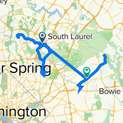
 13200 Bellevue St, Silver Spring to 4704 Riverdale Rd, Riverdale Park
- Distance
- 14.7 km
- Ascent
- 67 m
- Descent
- 146 m
- Location
- Calverton, Maryland, United States of America
 Beltsville Drive 12137 to Glenn Dale Boulevard 11999
- Distance
- 87.3 km
- Ascent
- 625 m
- Descent
- 593 m
- Location
- Calverton, Maryland, United States of America
 Steady ride in
- Distance
- 10.9 km
- Ascent
- 2,069 m
- Descent
- 2,081 m
- Location
- Calverton, Maryland, United States of America
 vicino casa
- Distance
- 11.3 km
- Ascent
- 132 m
- Descent
- 133 m
- Location
- Calverton, Maryland, United States of America
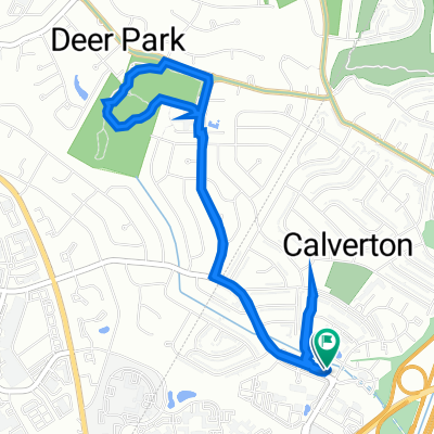
 Powder Mill Rd, Beltsville a Paint Branch Trail, College Park
- Distance
- 7 km
- Ascent
- 38 m
- Descent
- 79 m
- Location
- Calverton, Maryland, United States of America
 Cherry Hill Road 12060, Beltsville to Gateway Overlook Drive 8210, Elkridge
- Distance
- 697.7 km
- Ascent
- 2,201 m
- Descent
- 2,213 m
- Location
- Calverton, Maryland, United States of America
 Red Route
- Distance
- 134 km
- Ascent
- 702 m
- Descent
- 750 m
- Location
- Calverton, Maryland, United States of America
 Lighthouse Way 3906, Calverton to Lighthouse Way 3906, Calverton
- Distance
- 6.1 km
- Ascent
- 76 m
- Descent
- 44 m
- Location
- Calverton, Maryland, United States of America
Open it in the app